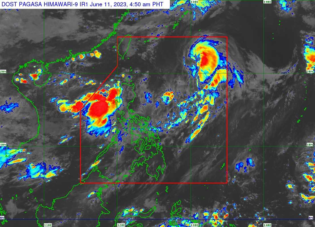

The Philippine Atmospheric, Geophysical, and Astronomical Services Administration (PAGASA) reported that Typhoon Chedeng was accelerating as it moved farther away from the Philippine landmass.
Meanwhile, the Southwest Monsoon, locally known as Habagat, continued to bring rainfall to the country.
At 4 AM, Sunday, Chedeng was estimated to be located around 990 km east of Extreme Northern Luzon.
It continued to weaken, with maximum sustained winds near the center reaching 130 km/h and gusts up to 160 km/h.
The central pressure stood at 970 hPa. Moving at a speed of 20 km/h in a north-northeastward direction, Chedeng's strong to typhoon-force winds extended outward up to 440 km from its center.
PAGASA stated that no tropical cyclone wind signals were in effect and that Chedeng was unlikely to bring heavy rainfall directly over the country in the next three days.
However, the Southwest Monsoon, enhanced by Chedeng, would result in occasional to monsoon rains over the western parts of Luzon and Visayas during the same period.
PAGASA warned of heavy rainfall in certain regions.
Rainfall
On Sunday and until Monday night, Zambales and Bataan were expected to experience rainfall of 100 to 200 mm.
Additionally, Pangasinan, Metro Manila, Bulacan, Occidental Mindoro, the northern portion of Palawan (including Calamian and Cuyo Islands), and Antique would have 50 to 100 mm of rainfall on Sunday.
From Sunday night to Monday night, the Ilocos Region, Abra, Benguet, Occidental Mindoro, and the northern portion of Palawan (including Calamian and Cuyo Islands) were expected to receive 50 to 100 mm of rainfall.
The Ilocos Region, Apayao, Abra, Zambales, Bataan, and Occidental Mindoro could also anticipate 50 to 100 mm of rainfall from Monday night to Tuesday night.
PAGASA advised caution as flooding and rain-induced landslides were possible, especially in areas prone to these hazards.
Gusty conditions were expected in various regions, including Batanes, Babuyan Islands, Ilocos Region, Cordillera Administrative Region, Nueva Vizcaya, Central Luzon, Metro Manila, CALABARZON, MIMAROPA, Bicol Region, and Western Visayas, particularly in coastal and upland/mountainous areas exposed to winds.
Chedeng was expected to exit the Philippine Area of Responsibility (PAR) on Sunday night or early Monday morning.
It might be downgraded to a severe tropical storm on Sunday or early Monday morning due to its weakening condition.
