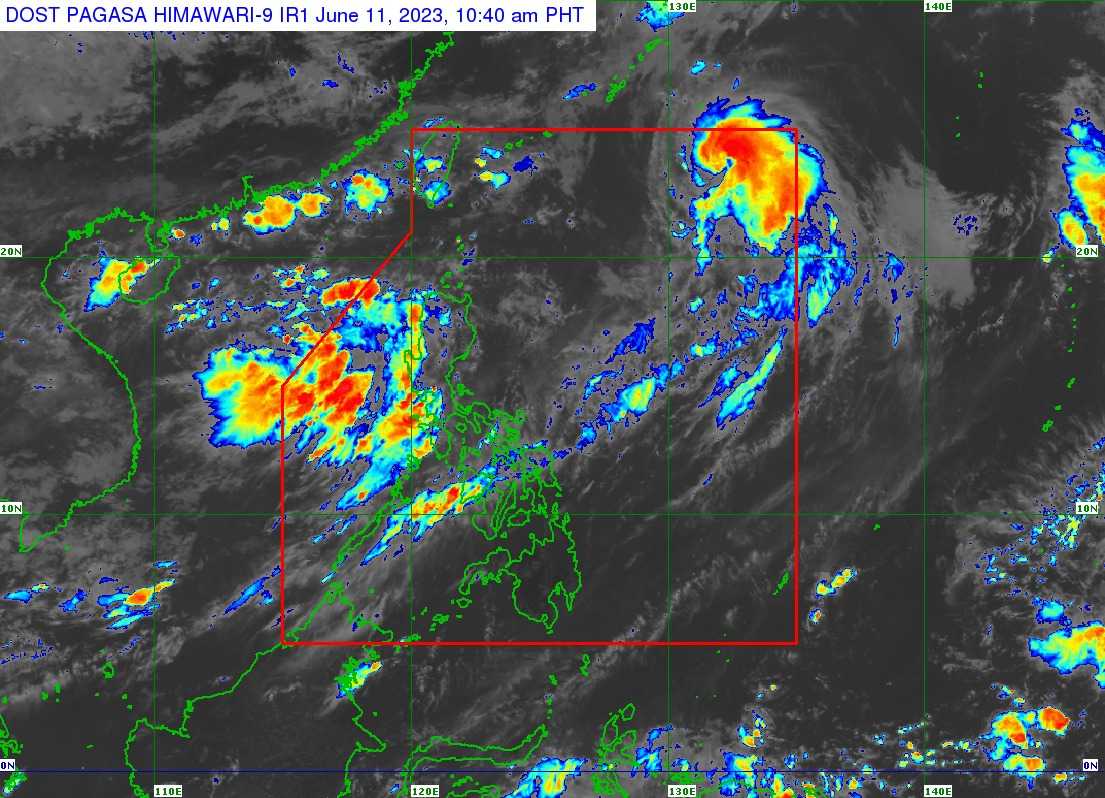

The latest update on Typhoon Chedeng reveals that it continues to weaken and accelerate its movement towards the north-northeast direction over the Philippine Sea.
As of 10:00 AM, the center of Typhoon Chedeng was located approximately 1,100 km East Northeast of Extreme Northern Luzon.
It is characterized by maximum sustained winds of 120 km/h near the center, gustiness of up to 150 km/h, and a central pressure of 975 hPa.
The typhoon is currently moving at a speed of 25 km/h in a north-northeastward direction.
Rainfall due to Habagat
While Typhoon Chedeng is not expected to bring heavy rainfall directly to the country in the next three days, it will enhance the Southwest Monsoon, or 'Habagat', resulting in occasional monsoon rains over the western parts of Luzon and Visayas within the same period.
No wind signals are expected to be hoisted due to Typhoon Chedeng.
However, the enhancement of the Southwest Monsoon over the next two days may cause gusty conditions in several areas, particularly those in coastal and upland/mountainous localities.
Today, these areas include Batanes, Babuyan Islands, Ilocos Region, Cordillera Administrative Region, Nueva Vizcaya, Central Luzon, Metro Manila, CALABARZON, MIMAROPA, Bicol Region, and Western Visayas.
Tomorrow, the same conditions are anticipated in Batanes, Babuyan Islands, Ilocos Region, Cordillera Administrative Region, Nueva Vizcaya, Central Luzon, Metro Manila, CALABARZON, Occidental Mindoro, Oriental Mindoro, Romblon, Marinduque, northern mainland Palawan, Calamian Islands, Cuyo Islands, Kalayaan Islands, Bicol Region, and Western Visayas.
Gusty conditions are expected to persist over most parts of Luzon from Tuesday onwards due to the Southwest Monsoon enhancement caused by another weather system.
Coastal waters
In terms of coastal waters, moderate to rough seas (2.0 to 3.0 m) are expected over the seaboard of Extreme Northern Luzon in the next 24 hours.
Mariners of small seacrafts are advised to take precautionary measures and avoid venturing out to sea if they are inexperienced or operating ill-equipped vessels.
Typhoon Chedeng is projected to continue moving away from the Philippine landmass. It is forecasted to accelerate northeastward and exit the Philippine Area of Responsibility (PAR) tonight.
Throughout the forecast period, the typhoon will gradually weaken due to increasingly unfavorable conditions. It is anticipated to be downgraded into a severe tropical storm within the day.
