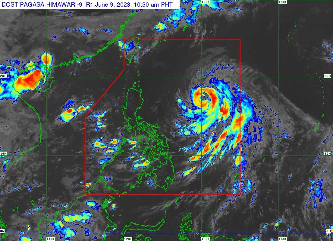

Typhoon Chedeng may enhance the Southwest monsoon and this may bring occasional rains in some areas of southwestern Luzon in the next few days, according to the Philippine Atmospheric, Geophysical and Astronomical Services Administration (PAGASA) on Friday.
In its latest tropical cyclone bulletin, PAGASA said Chedeng continues to maintain its strength while moving in the Philippine Sea east of Northern Luzon.
As of 10 AM, the eye of the typhoon was last seen 920 kilometers East of Northern Luzon.
It has maximum sustained winds of 130 kilometers per hour (kph) near the center, gustiness of up to 160 kph, and a central pressure of 975 hPa as it moves North northwestward at the speed of 10 kph.
The state weather bureau said Chedeng will still remain far from the country’s landmass, hence heavy rainfall is unlikely and the hoisting of Tropical Wind Signal Numbers is likewise not likely.
The typhoon will also cause moderate to rough seas over the seaboard of Extreme Northern Luzon and the eastern seaboard of mainland Northern Luzon.
The state weather bureau advised inexperienced mariners to avoid sailing out the sea while small seacraft marines are asked to take precautionary measures.
Based on PAGASA’s forecast, Chedeng will move northeastward towards the sea south of Japan on Sunday and exit the Philippine Area of Responsibility (PAR) on Monday.
