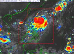
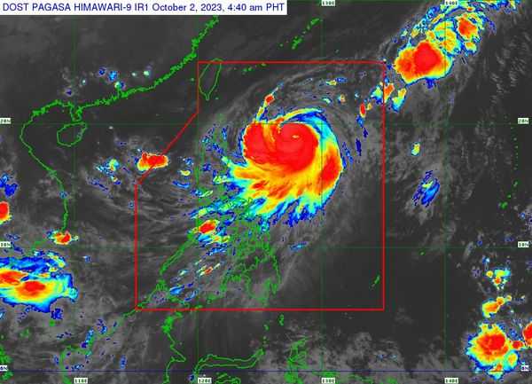
Severe Tropical Storm (STS) Jenny has entered the Philippine Area of Responsibility (PAR) and intensified into a typhoon before dawn on Monday, according to PAGASA.
Based on the weather bureau's bulletin, Tropical Cyclone Wind Signal (TCWS) No. 1 was raised over the following areas:
- Batanes
- Babuyan Islands
- Eastern portion of mainland Cagayan (Santa Ana, Gonzaga, Buguey, Santa Teresita, Lal-Lo, Baggao, Gattaran, Peñablanca)
- Eastern portion of Isabela (Maconacon, Divilacan, Palanan).
The forecast accumulated rainfall from Tuesday evening to Wednesday evening, with strong winds ranging from 39 to 61 km/h and minimal to minor threats to life and property.
The center of Typhoon Jenny was estimated to be located at 655 kilometers (km) east of Aparri, Cagayan, or 665 km east of Calayan, Cagayan, at 4 a.m.
The typhoon has maximum sustained winds of 120 km/h near the center, gustiness of up to 150 km/h, and a central pressure of 975 hPa.
It is moving northwestward at 10 km/h.
From its center, strong to typhoon-force winds are extending outwards up to 560 km.
Jenny will continue to enhance the Southwest Monsoon and bring occasional monsoon rains over the western portions of Central Luzon, Southern Luzon, Visayas, and Mindanao in the next 3 days.