
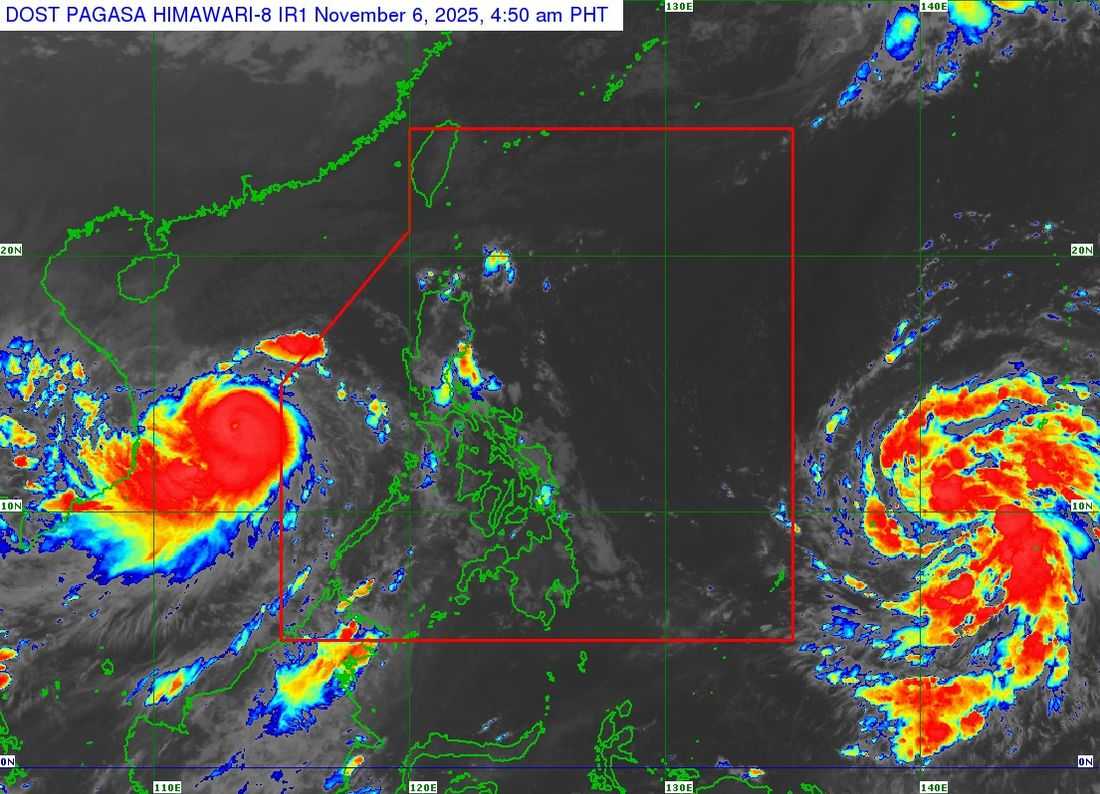
As of 5:00 AM on November 6, Thursday, Typhoon Tino has strengthened while moving over the West Philippine Sea, north of the Kalayaan Islands, PAGASA reported.
The storm’s center is about 265 km north-northwest of Pag-asa Island, Palawan, outside the Philippine Area of Responsibility (PAR).
Tino has maximum sustained winds of 155 km/h, gusts up to 190 km/h, and a central pressure of 960 hPa. Tropical Cyclone Wind Signal No. 1 is in effect over the Kalayaan Islands.
Strong winds may also affect other coastal and mountainous areas, including:
-
Batanes
-
Babuyan Islands
-
Ilocos Norte
-
Pangasinan
-
Zambales
-
Bataan
-
Cavite
-
Batangas
-
Occidental and Oriental Mindoro
-
Romblon
-
Palawan
-
Antique
Seas may reach up to 4 meters in the northern seaboards of Kalayaan Islands, up to 3 meters along western Palawan, Batanes, Ilocos Norte, and Babuyan Islands, and up to 2–2.5 meters in other coastal areas.
Small seacrafts, including motorbancas, are strongly urged to avoid venturing out to sea, while larger vessels should exercise caution.
Tino has exited the PAR as of 12:30 AM and is moving west-northwest toward central Vietnam. It may weaken slightly before landfall and will rapidly lose strength after hitting land.
New System: Tropical Storm ‘Fung-Wong’
A tropical depression outside the PAR has strengthened into Tropical Storm Fung-Wong. Moving northwest at 20 km/h, it is expected to enter the PAR late Friday or early Saturday, where it will be named “Uwan.”
Authorities continue to monitor both storms and advise residents to stay alert.