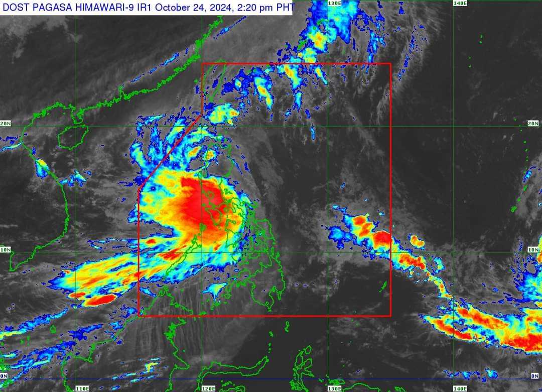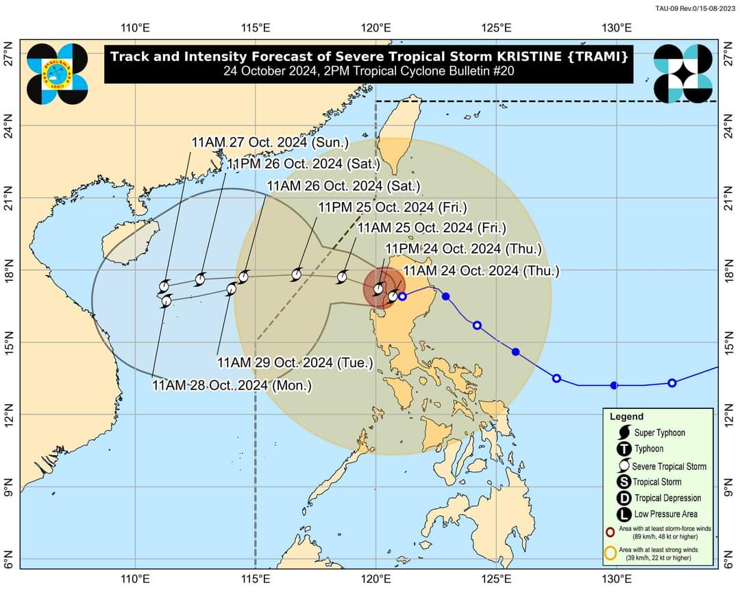

Severe Tropical Storm ‘Kristine’ is currently over the coastal waters of Southern Ilocos Sur, and is forecasted to move westward or west northwestward over the West Philippine Sea (WPS) by Friday, October 25.
PAGASA’s tropical cyclone bulletin at 2:00 PM, indicated that Kristine may exit the Philippine Area of Responsibility (PAR) region by Friday afternoon. However, the extended outlook said that there is a developing forecast situation that indicates Kristine looping over the WPS on Sunday and Monday.
From there, it will move eastward or east northwestward towards the general direction of the PAR region. The PAGASA noted that the scenario heavily depends on the behavior of the weather disturbance east of the PAR region. It added that Kristine is also expected to downgrade nto a tropical depression within the next 24 hours.
The severe tropical storm is forecasted to re-intensify as it moves over the WPS. It is also likely that it will remain a severe tropical storm in the next five days.
However, the chance for it to be upgraded into a typhoon is not ruled out.

Photo from PAGASA.
“Considering these developments, the public and disaster risk reduction and management offices concerned are advised to take all necessary measures to protect life and property,” PAGASA said.
“Persons living in areas identified to be highly or very highly susceptible to these hazards are advised to follow evacuation and other instructions from local officials,” it added.
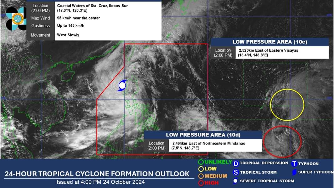
Meanwhile, PAGASA's 4:00 PM tropical cyclone update found that the low pressure area outside the PAR, has a high chance to develop into a tropical depression within the next 24 hours.
Consequently, another low-pressure area (10e) being monitored within the PAGASA monitoring domain has a low chance of developing into a tropical depression within the next 24 hours.

photo from PAGASA.
