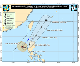
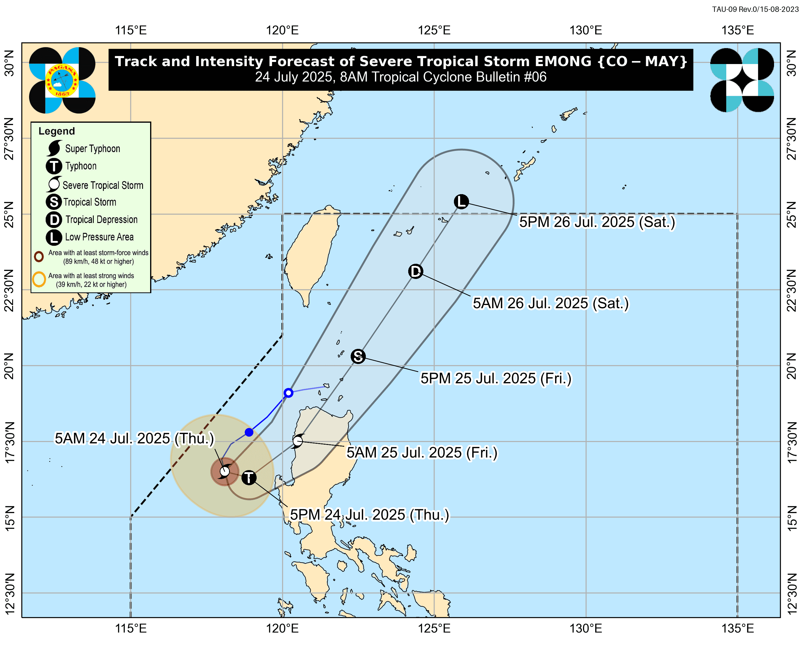
Severe Tropical Storm (STS) Emong maintained its strength as it moved southeastward, prompting the hoisting of Tropical Cyclone Wind Signals (TCWS) across Luzon.
In its 8:00 AM bulletin, PAGASA reported that Emong's center was spotted 245 km west northwest of Bacnotan, La Union. It was packing maximum sustained winds of 110 km/h near the center and gustiness of up to 135 km/h while moving south southwestward at 15 km/h.
As a result, the following wind signals have been raised:
Signal No. 3
- The northern portion of Pangasinan (Anda, Bolinao, Bani)
- the western portion of La Union (Luna, Balaoan, Bacnotan, San Juan, City of San Fernando, Bauang, Caba)
Signal No. 2
- Ilocos Norte, Ilocos Sur, the rest of La Union, the western portion of Apayao (Conner, Kabugao, Calanasan)
- Abra
- Kalinga
- Mountain Province
- Ifugao
- Benguet
- the central portion of Pangasinan (Agno, Burgos, Mabini, City of Alaminos, Sual, Labrador, Bugallon, Infanta, Dasol, Lingayen, Binmaley, Dagupan City, Calasiao, Santa Barbara, Mangaldan, Mapandan, Manaoag, Laoac, Binalonan, San Manuel, San Nicolas, Pozorrubio, Sison, San Fabian, San Jacinto)
- the western portion of Nueva Vizcaya (Kayapa, Santa Fe)
Signal No. 1
- Batanes
- Cagayan including Babuyan Islands
- the western and central portions of Isabela (Santo Tomas, Delfin Albano, Quezon, Mallig, Quirino, Roxas, San Manuel, Aurora, San Mateo, Ramon, Cordon, Burgos, Cabatuan, Cabagan, San Pablo, Santa Maria, Tumauini, Gamu, Luna, Maconacon, Alicia, San Mariano, Naguilian, San Guillermo, City of Cauayan, Echague, Ilagan City, Angadanan, Benito Soliven, City of Santiago, Reina Mercedes, San Agustin, Divilacan, San Isidro, Jones)
- the rest of Nueva Vizcaya
- Quirino
- the rest of Apayao
- the rest of Pangasinan
- the northern and central portions of Zambales (Santa Cruz, Candelaria, Masinloc, Palauig, Iba, Botolan, Cabangan)
- Tarlac
- the western and central portions of Nueva Ecija (Carranglan, Lupao, Talugtug, Cuyapo, Nampicuan, Guimba, Science City of Muñoz, San Jose City, Pantabangan, Rizal, Llanera, Talavera, Santo Domingo, Quezon, Licab, Aliaga, Zaragoza, San Antonio, Jaen, Cabanatuan City, Santa Rosa, General Mamerto Natividad, Palayan City, Bongabon, Laur)
"The wind signals warn the public of the general wind threat over an area due to the tropical cyclone. Local winds may be slightly stronger/enhanced in coastal and upland/mountainous areas exposed to winds. Winds are less strong in areas sheltered from the prevailing wind direction," said PAGASA.
According to the weather bureau, the highest wind signal that may be hoisted during Emong's passage is Signal No. 4.
Meanwhile, the Southwest Monsoon will bring strong to gale-force gusts today in Metro Manila, the rest of Central Luzon, CALABARZON, Bicol Region, MIMAROPA, Visayas, Zamboanga del Norte, Misamis Occidental, Lanao del Norte, Camiguin, Dinagat Islands, and Davao Oriental.
STS Emong is forecast to move generally southeastward before turning north northeastward within the next 24 hours, according to PAGASA.
On the forecast track, Emong may pass close to Pangasinan this afternoon and could make landfall over the Ilocos Region tonight or early morning of July 24.
After crossing Northern Luzon, the center of Emong will likely re-emerge over the Luzon Strait and may pass close to the Babuyan Islands.
“Emong may intensify into a typhoon prior to its landfall,” PAGASA added.