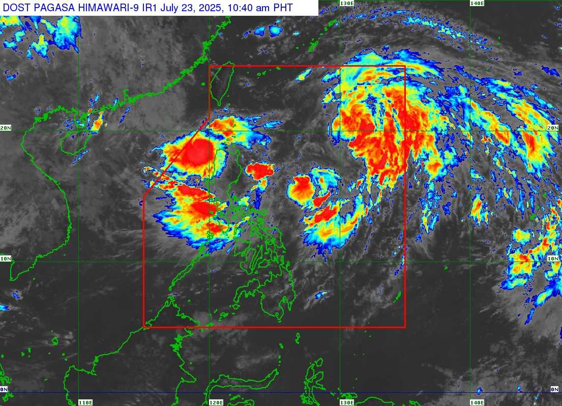
The Low Pressure Area (LPA) west of the Babuyan Islands has developed into Tropical Depression "Emong," while Tropical Depression "Dante" has intensified into a Tropical Storm. Both systems are currently within the Philippine Area of Responsibility (PAR).
According to the latest weather forecast issued by the Philippine Atmospheric, Geophysical and Astronomical Services Administration (PAGASA) at 11:00 AM on July 23, Emong was last located 115 km west-northwest of Laoag City, Ilocos Norte. It has maximum sustained winds of 45 km/h near the center and gusts of up to 55 km/h, moving west-southwestward at 35 km/h.
Meanwhile, Tropical Storm Dante was last spotted 900 km east of extreme Northern Luzon. It has maximum sustained winds of 65 km/h near the center and is moving north-northwestward at 15 km/h.
Tropical Cyclone Wind Signals (TCWS) No.1 is being raised in some part of Luzon caused by Tropical Depression Emong:
- Ilocos Norte
- the western portion of Ilocos Sur (Sinait, San Juan, Cabugao, Santo Domingo, Magsingal, Bantay, San Ildefonso, San Vicente, Santa Catalina, City of Vigan, Caoayan, Santa, Narvacan, Santa Maria, San Esteban, Santiago, City of Candon, Santa Lucia, Santa Cruz, Tagudin)
- Northwestern portion of La Union (City of San Fernando, San Juan, Bacnotan, Luna, Balaoan, Bangar, Bauang)
- Western portion of Pangasinan (Dasol, Burgos, Agno, Bani, Bolinao, City of Alaminos, Mabini, Anda)
Heavy rainfall is expected due to the southwest monsoon, which is being intensified by both Dante and Emong.
PAGASA has indicated that Dante may exit the Philippine Area of Responsibility (PAR) by tomorrow afternoon or evening, July 24.
Another LPA is being monitored outside of PAR, with a significant chance of developing into a tropical depression within the next 24 hours.
The weather bureau advises the public to stay alert for potential floods and other hazards that may arise during this weather situation.