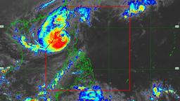
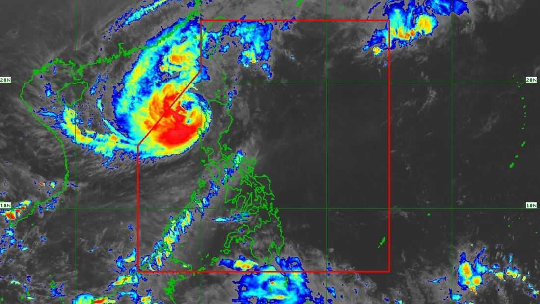
Typhoon “Uwan” continues to weaken as it moves away from the Ilocos Region, the PAGASA said.
Based on its tropical cyclone bulletin at 5:00 PM on Monday, November 10, the state weather bureau said the center of the typhoon was located at 175 km west of Sinait, Ilocos Sur.
It has maximum sustained winds of 120 km/h near the center, gustiness of up to 150 km/h, and a central pressure of 975 hPa. It is currently moving northwestward at 10 km/h.
Meanwhile, Tropical Cyclone Wind Signals (TCWS) Nos. 1 and 2 are in effect in several areas in the country:
TCWS No. 2
-
Batanes
-
Cagayan, including the Babuyan Islands
-
the northwestern portion of Isabela (Santo Tomas, Santa Maria, Quezon, Roxas, Delfin Albano, San Pablo, Cabagan, San Manuel, Mallig)
-
Apayao
-
Abra
-
Kalinga
-
Mountain Province
-
Ifugao
-
Benguet
-
Ilocos Norte
-
Ilocos Sur
-
La Union
-
the western and central portions of Pangasinan (Basista, Lingayen, City of Alaminos, Anda, Malasiqui, San Fabian, Mangaldan, Mapandan, Burgos, Dagupan City, Binalonan, Bolinao, Aguilar, San Manuel, Sual, Labrador, Bani, Pozorrubio, City of Urdaneta, Laoac, Mabini, San Carlos City, Manaoag, Binmaley, San Jacinto, Bugallon, Infanta, Agno, Calasiao, Santa Barbara, Dasol, Sison, Mangatarem, Urbiztondo)
-
the northern portion of Zambales (Santa Cruz, Candelaria)
TCWS No. 1
-
The rest of Isabela
-
Quirino
-
Nueva Vizcaya
-
the rest of Pangasinan
-
Aurora
-
Nueva Ecija
-
the rest of Zambales
-
Bataan
-
Tarlac
-
Pampanga
-
Bulacan
-
Metro Manila
-
Cavite
-
Laguna
-
Batangas
-
Rizal
-
Quezon, including the Polillo Islands
-
Occidental Mindoro, including the Lubang Islands
-
Oriental Mindoro
-
Marinduque
-
Calamian Islands
-
Camarines Norte
-
the northwestern portion of Camarines Sur (Sipocot, Libmanan, Lupi, Del Gallego, Ragay, Cabusao)
“Uwan” is forecast to exit the Philippine Area of Responsibility (PAR) by Monday evening (November 10) or early Tuesday (November 11). However, PAGASA said it may re-enter PAR on Wednesday (November 12) evening as it makes landfall along Taiwan's southwestern coast, resulting in further weakening.
“It will then emerge over the waters near Ryukyu Islands on Thursday (13 November), where it is expected to eventually weaken into a remnant low on Friday (14 November),” it said.