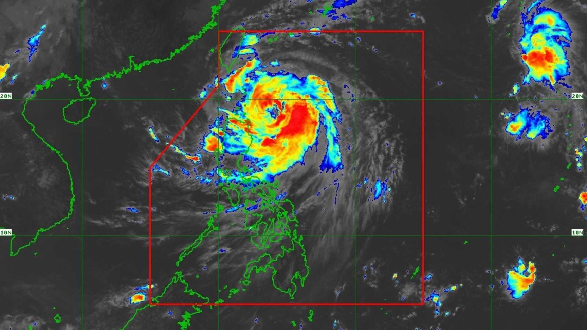

‘Julian’ intensified into a Typhoon and Tropical Cyclone Wind Signal (TCWS) No. 3 remains in effect for the northeastern section of the Babuyan Islands, as reported by the weather bureau on Sunday at 2 PM.
The location of the typhoon's eye is approximately 275 km east of Calayan, Cagayan, progressing northwestward at a speed of 15 km/h. Maximum sustained winds are measured at 120 km/h near the center, with gusts up to 150 km/h.
Moreover, the following areas are placed under Tropical Cyclone Wind Signal No. 2:
- The rest of Babuyan Islands (Camiguin, Calayan, Dalupiri, Fuga)
- Batanes
- mainland Cagayan
- Apayao
- northern and central portions of Ilocos Norte
The public is advised that localities under Wind Signal No. 2 may experience minor to moderate impacts due to strong winds.
Tropical Cyclone Wind Signal No. 1 is raised to the following areas:
- The rest of Ilocos Norte
- Ilocos Sur
- northern portion of La Union
- Abra
- Kalinga
- Ifugao
- Mountain Province
- northern and central portions of Benguet
- Isabela
- Nueva Vizcaya
- Quirino
- northern and central portions of Aurora
The public is cautioned that localities affected by Wind Signal No. 1 may encounter only minimal to minor impacts due to strong winds.
According to the weather bureau, the highest wind signal that may be hoisted during the occurrence of Julian is Wind Signal No. 4.
The track forecast indicates a high likelihood of landfall or close approach of Julian over Batanes and/or the Babuyan Islands by tomorrow, September 30.
Julian is projected to move generally west-northwestward to northwestward from today until Tuesday morning (October 1), heading toward the Batanes-Babuyan Islands area.
It is likely to move more quickly north to north-northeastward over the waters east of Taiwan from Tuesday afternoon onward.
