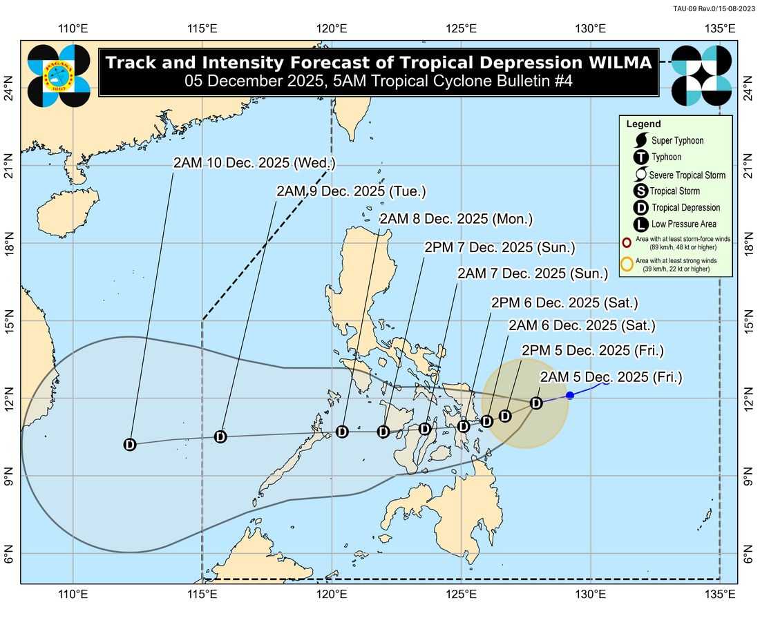
Tropical Depression Wilma slightly accelerated as it moved west-southwestward over the Philippine Sea, PAGASA reported Friday.
As of 5 a.m., Wilma was located about 245 kilometers east of Borongan City, Eastern Samar. It had maximum sustained winds of 45 kph near the center and gusts of up to 55 kph, moving west-southwestward at 20 kph.
Due to this, the Tropical Cyclone Warning Signal (TCWS) No. 1 has been raised in the following areas:
Luzon
-
Southern portion of Masbate: Cataingan, Pio V. Corpuz, Esperanza, Placer, Cawayan, Palanas, Dimasalang
Visayas
-
Northern Samar, Eastern Samar, Samar, Biliran, Leyte, Southern Leyte
-
Northern and central Cebu including Bantayan and Camotes Islands
-
Bohol
-
Northern and eastern Negros Occidental
-
Northern Negros Oriental
-
Eastern Iloilo
-
Eastern Capiz
Mindanao
-
Surigao del Norte including Siargao and Bucas Grande Islands
-
Dinagat Islands
-
Northern Surigao del Sur
-
Northern Agusan del Norte
-
Camiguin
PAGASA warned that heavy rains and strong winds may still affect areas outside the forecast track. The storm’s path may also change within the forecast confidence cone.
Wilma is forecast to continue moving west-southwestward until Saturday before turning westward. It may make landfall or pass close to Eastern Visayas or the Dinagat Islands between Friday evening and Saturday morning.
The weather bureau said Wilma is expected to slightly intensify before landfall but will likely remain a tropical depression.
Further strengthening is possible once it enters the West Philippine Sea.