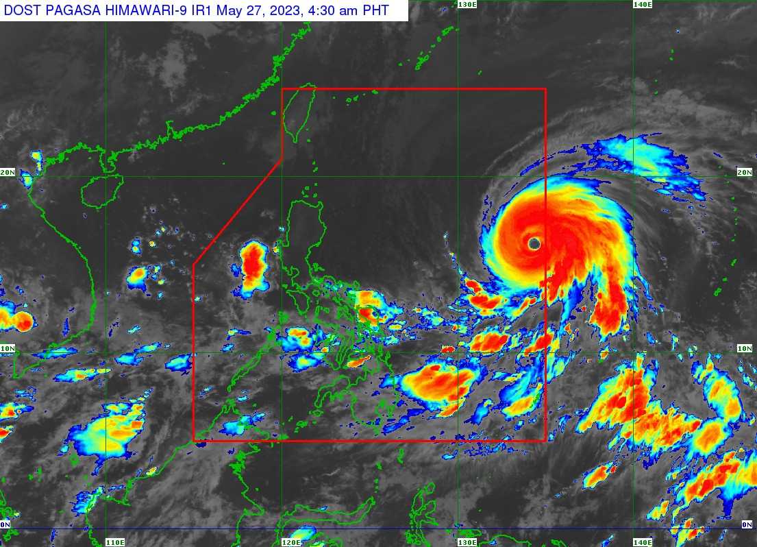

Super Typhoon Mawar, now called by its local name Betty, entered the Philippine Area of Responsibility (PAR) on Saturday morning, the Philippine Atmospheric, Geophysical and Astronomical Services Administration (PAGASA) said.
In a press briefing, PAGASA weather forecaster Partick Del Mundo said the center of the eye of Super Typhoon Betty was last spotted 1,320 kilometers East of Central Luzon, and it is moving west-northwestward at 25 kilometers per hour.
It has a strength of 195 km/h near the center and a gustiness of up to 240 km/h.
Del Mundo said Betty will remain in the Super Typhoon category over the weekend.
"Pagsapit naman ng Lunes hanggang sa Miyerkules, eto 'yung pinaka-crucial na part dahil pinaka-malapit ito sa ating kalupaan, particularly dito sa Batanes ang Babuyan Island, around 250 hanggang 300 kilometers away na lamang mula sa kaniyang mata," he said.
The state weather forecaster said Super Typhoon Betty would bring heavy rains and strong winds in Northern Luzon, particularly Cagayan Valley, Aurora's Northern and Eastern portions of Cordirella, and even Ilocos Sur.
He said that the Super Typhoon is expected to slow down on Monday or Tuesday.
"Crucial din ang part na ito dahil kapag mabagal ang isang bagyo, mas matagal ang epekto ng hangin at ulan dito sa ating kababayan sa Northern Luzon," Del Mundo noted.
He said PAGASA will raise Tropical Wind Signals in some areas in Northern Luzon on Saturday night or Sunday morning.
Super Typhoon is expected to weaken and move away from PAR by Thursday.
"Ilang araw pa na mananatili sa PAR itong si Bagyong Betty, and based sa ating latest track ay hindi naman tatama 'yung center ng bagyo sa ating kalupaan," Del Mundo said.
Meanwhile, the PAGASA weather forecaster said that the enhanced Southwest monsoon will bring rains over the Western sections of Mimaropa, Visayas, and Mindanao on Sunday.
On Monday and Tuesday, monsoon rains are likely over Mimaropa and Western Visayas.
