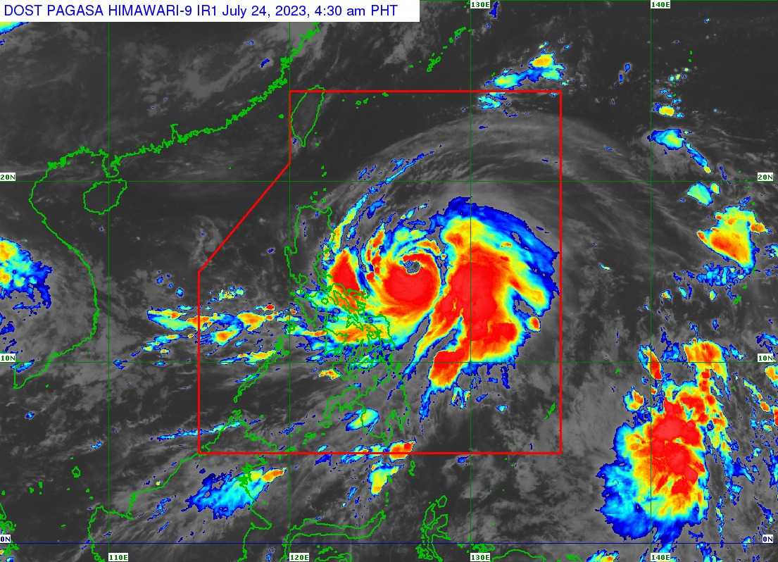

Tropical Cyclone Wind Signal (TCWS) No. 2 has been hoisted in the southeastern portion of Isabela and the northeastern portion of Catanduanes as Typhoon Egay intensifies over the Philippine Sea, according to the latest bulletin issued by PAGASA on Monday, July 24.
As of 4 AM, Typhoon Egay was spotted 565 kilometers East of Baler, Aurora with maximum sustained winds of 140 kilometers per hour (kPh), gustiness of up to 170 kPh, and central pressure of 965 hPa.
It is presently headed westward at the speed of 15 kPh and is forecasted to turn northwestward and move close to the landmass of Northern Luzon towards the Luzon Strait.
"EGAY is forecast to continue intensifying and reach super typhoon category by late tomorrow or early Wednesday," PAGASA said, adding that Egay may become a very strong typhoon.
The state weather bureau stated that Typhoon Egay may landfall or pass very close to Babuyan Islands-Batanes by Tuesday evening or Wednesday afternoon.
PAGASA noted that it is not ruling out the possibility that the typhoon will make landfall in the northeastern portion of mainland Cagayan.
The following areas are placed under TCWS No. 2:
- The southeastern portion of Isabela (Palanan, Dinapigue)
- The northeastern portion of Catanduanes (Pandan, Bagamanoc, Panganiban, Viga, Gigmoto)
According to PAGASA, the aformentioned areas may experience minor to moderate impacts from gale-force wind that may cause minor to moderate threat to life and property.
Meanwhile, TCWS No. 1 has been raised over the areas of:
- Batanes
- Cagayan including Babuyan Islands
- the rest of Isabela
- Quirino
- Nueva Vizcaya
- Apayao
- Kalinga
- Abra
- Mountain Province
- Ifugao
- Benguet
- Ilocos Norte
- Ilocos Sur
- La Union
- The northern portion of Pangasinan (Natividad, San Nicolas, San Quintin, Sison, Pozorrubio, San Manuel, San Fabian, Anda, Bolinao, San Jacinto, Manaoag, Laoac, Binalonan, Asingan, Tayug, Santa Maria, Umingan, Dagupan City, Mangaldan)
- Aurora
- The northern and eastern portions of Nueva Ecija (Carranglan, Bongabon, Gabaldon, Pantabangan, Lupao, San Jose City)
- The northern and southeastern portions of Quezon (Pitogo, San Andres, Buenavista, San Francisco, Calauag, Infanta, Lopez, Catanauan, Mulanay, Guinayangan, Unisan, General Luna, Plaridel, Quezon, Alabat, Padre Burgos, Macalelon, Mauban, General Nakar, Perez, Agdangan, Gumaca, Atimonan, Real, SanNarciso, Tagkawayan) including Polillo Islands
- Camarines Norte
- Camarines Sur
- The rest of Catanduanes
- Albay
- Sorsogon
- Masbate
Minimal to minor impacts from strong wind may be felt in areas under TCWS No. 1, the state weather bureau warned.
PAGASA also said that Typhoon Egay and the Southwest Monsoon or habagat may cause gusty conditions, especially in coastal and upland or mountainous areas that are exposed to winds.
On Monday, CALABARZON, MIMAROPA, Visayas, and the northern portions of Zamboanga Peninsula, Northern Mindanao, and Caraga will have gusty conditions.
"In addition, EGAY may also enhance the Southwest Monsoon, bringing occasional to monsoon rains over the western portions of Central Luzon, Southern Luzon, and Visayas in the next three days," the state weather bureau said.
