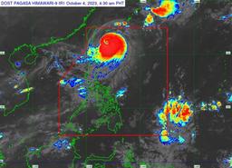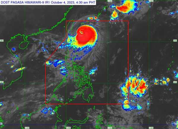

Typhoon Jenny slightly weakens while traveling toward southern Taiwan, but Tropical Cyclone Wind Signals (TCWs) remain hoisted in several areas in Luzon, according to the weather bureau on Wednesday, Oct. 4.
In its 5 AM bulletin, PAGASA said the center of the eye of Typhoon Jenny was last tracked 270 kilometers (km) east northeast of Itbayat, Batanes, and is heading west northwestward at 10 km per hour (kph) speed.
Typhoon Jenny has 150 kph maximum sustained winds near the center and 185 kph gustiness.
TCWS No. 3 is hoisted in:
- Itbayat, Batanes
TCWS No. 3 is raised in the following areas:
- The rest of Batanes
- The northern portion of Babuyan Islands
TCWS No. 1 is up inte areas of:
- The rest of Babuyan Islands
- The northern portion of mainland Cagayan (Santa Ana, Gonzaga, Buguey, Santa Teresita, Lal-Lo, Camalaniugan, Pamplona, Claveria, Aparri, Ballesteros, Abulug, Allacapan, Sanchez-Mira, Santa Praxedes, Lasam, Gattaran)
- The northern portion of Apayao (Calanasan, Pudtol, Luna, Santa Marcela, Flora)
- The northern portion of Ilocos Norte (Piddig, Bangui, Vintar, Burgos, Pagudpud, Bacarra, Adams, Pasuquin, Carasi, Dumalneg, Laoag City)
According to the state weather bureau, Typhoon Jenny is expected make landfall over the southern portion of Taiwan on Thursday morning, Oct. 5, and depart the Philippine Area of Responsibility (PAR) in the afternoon or evening of the same day.
"Outside the PAR region, JENNY will continue moving westward slowly over the Taiwan Strait and the coastal waters of southeastern China," it said.
PAGASA said the typhoon will continue to weaken until it pass over southern Taiwan.
A gale warning remains in effect in the coastal waters along the seaboards of Northern Luzon due to the moderate to rough seas brought by Typhoon Jenny.
Western portions of Luzon will experience occasional rains due to the Southwest Monsoon or habagat enhanced by Jenny.
