Babuyan Island remained under Tropical Cyclone Wind Signal (TCWS) No. 3 as Typhoon Goring drew nears Luzon Strait, the state weather bureau said on Tuesday, August 29.
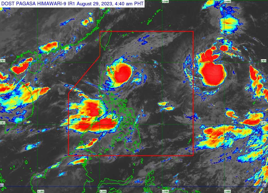
In its 5 AM bulletin, PAGASA said it tracked the center of the eye of Goring at 220 kilometers (km) East of Aparri in Cagayan.
Goring has maximum sustained winds of 155 kph near the center and gustiness of up to 190 kph.
The typhoon is accelerating north-northwestward at the speed of 10 km per hour (kph) and is forecasted to continue mainly northwestward or west-northwestward path across the Luzon Strait.
The state weather bureau said Goring may pass very close or make landfall in the vicinity of Batanes by tomorrow morning and afternoon.
"During this period, the typhoon is forecast to re-intensify and may peak at near-super typhoon strength by the time it passes very close or over Batanes (although re-intensifying into a super typhoon is not ruled out)," it noted.
TCWS No. 3 is hoisted in:
- The northeastern portion of Babuyan Islands (Babuyan Island)
TCWS No. 2 is up in the areas of:
- Batanes
- the rest of Babuyan Islands
- the extreme northeastern portion of mainland Cagayan (Santa Ana, Gonzaga)
TCWS No. 1 is placed in the following areas:
- The northern and eastern portions of mainland Cagayan (Camalaniugan, Pamplona, Santa Teresita, Baggao, Buguey, Claveria,
- Aparri, Ballesteros, Abulug, Sanchez-Mira, Santa Praxedes, Allacapan, Lal-Lo, Lasam, Peñablanca, Iguig, Amulung, Gattaran, Alcala, Santo Niño
- the eastern portion of Isabela (Dinapigue, San Mariano, Ilagan City, Tumauini, San Pablo, Cabagan, Maconacon, Divilacan, Palanan),
- the northern portion of Apayao (Flora, Calanasan, Luna, Pudtol, Santa Marcela)
- the northern portion of Ilocos Norte (Vintar, Pasuquin, Burgos, Dumalneg, Adams, Pagudpud, Bangui)
"The wind signals warn the public of the general wind threat over an area due to the tropical cyclone. Local winds may be slightly stronger/enhanced in coastal and upland/mountainous areas exposed to winds. Winds are less strong in areas sheltered from the prevailing wind direction," PAGASA said.
It said TCWS No. 4 is possible over Extreme Northern Luzon due to Goring-induced winds.
The state weather bureau said Goring may exit the Philippine Area of Responsibility (PAR) on Wednesday evening or Thursday morning.
A gale warning is in effect over the Northern and eastern seaboards of Northern Luzon, the eastern and western seaboards of Central Luzon, the seaboards of Southern Luzon, the seaboards of Visayas, and the northern seaboard of Mindanao.