
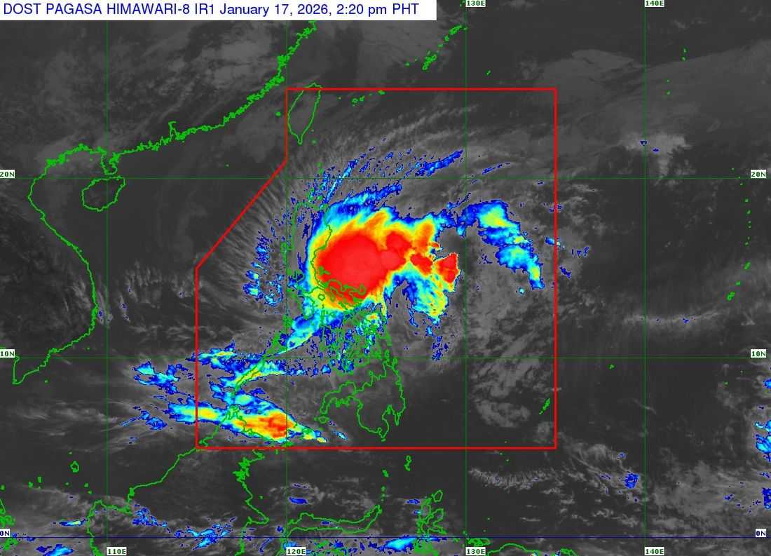
The Tropical Cyclone Wind Signal (TCWS) No. 2 remains in effect over several parts of Luzon due to Tropical Storm Ada, according to PAGASA on Saturday, January 17.
In its 2 p.m. bulletin, the center of Tropical Storm Ada was located approximately 95 kilometers east-northeast of Virac, Catanduanes, or 220 kilometers east of Daet, Camarines Norte.
The storm is moving northward at 15 km/h. It has maximum sustained winds of 85 km/h near the center, gusts reaching up to 105 km/h, and a central pressure of 994 hPa.
Areas under TCWS:
TCWS No. 2:
- Eastern Camarines Norte: Vinzons, San Lorenzo Ruiz, San Vicente, Talisay, Basud, Mercedes, Daet, Paracale
- Eastern and Central Camarines Sur: Siruma, Tinambac, Ocampo, Goa, Lagonoy, Milaor, Nabua, Buhi, Caramoan, Baao, Cabusao, Bato, Camaligan, Pili, Sipocot, Tigaon, Pamplona, Garchitorena, Iriga City, San Fernando, Magarao, Minalabac, Balatan, Libmanan, Naga City, Calabanga, Bombon, Bula, Canaman, Pasacao, Sagñay, San Jose, Presentacion, Gainza, Lupi
- Catanduanes
- Albay
- Northern Sorsogon: City of Sorsogon, Barcelona, Magallanes, Pilar, Castilla, Gubat, Casiguran, Donsol, Juban, Prieto Diaz
TCWS No. 1:
- Luzon: Eastern Quezon including Polillo Islands, Marinduque, Eastern Romblon, remaining parts of Camarines Norte, Camarines Sur, and Sorsogon, Masbate
- Visayas: Northern Samar, Eastern Samar, Samar, Biliran, northern Leyte, northern Cebu including Bantayan Islands
Authorities warn that heavy rainfall and strong winds may still affect areas outside the projected path. PAGASA advises monitoring local forecasts for updates on other hazards.
"ADA will move generally northwestward today before slowly turning northward to northeastward tomorrow (18 January). From tomorrow onwards, ADA is forecast to move slowly in a looping pattern over the sea east of Southern Luzon," PAGASA said.
There is a possibility of a westward shift, which could bring Ada closer to Catanduanes. "ADA is forecast to remain as a tropical storm while moving over the sea east of Southern Luzon. However, further intensification to severe tropical storm is not ruled out," the bureau stated.
ADA is expected to weaken into a tropical depression by the afternoon or evening of Tuesday, January 20, due to the northeast monsoon surge.
Authorities urged the public and local disaster risk reduction and management offices to take necessary precautions to protect life and property, and to follow advisories and instructions from local officials.