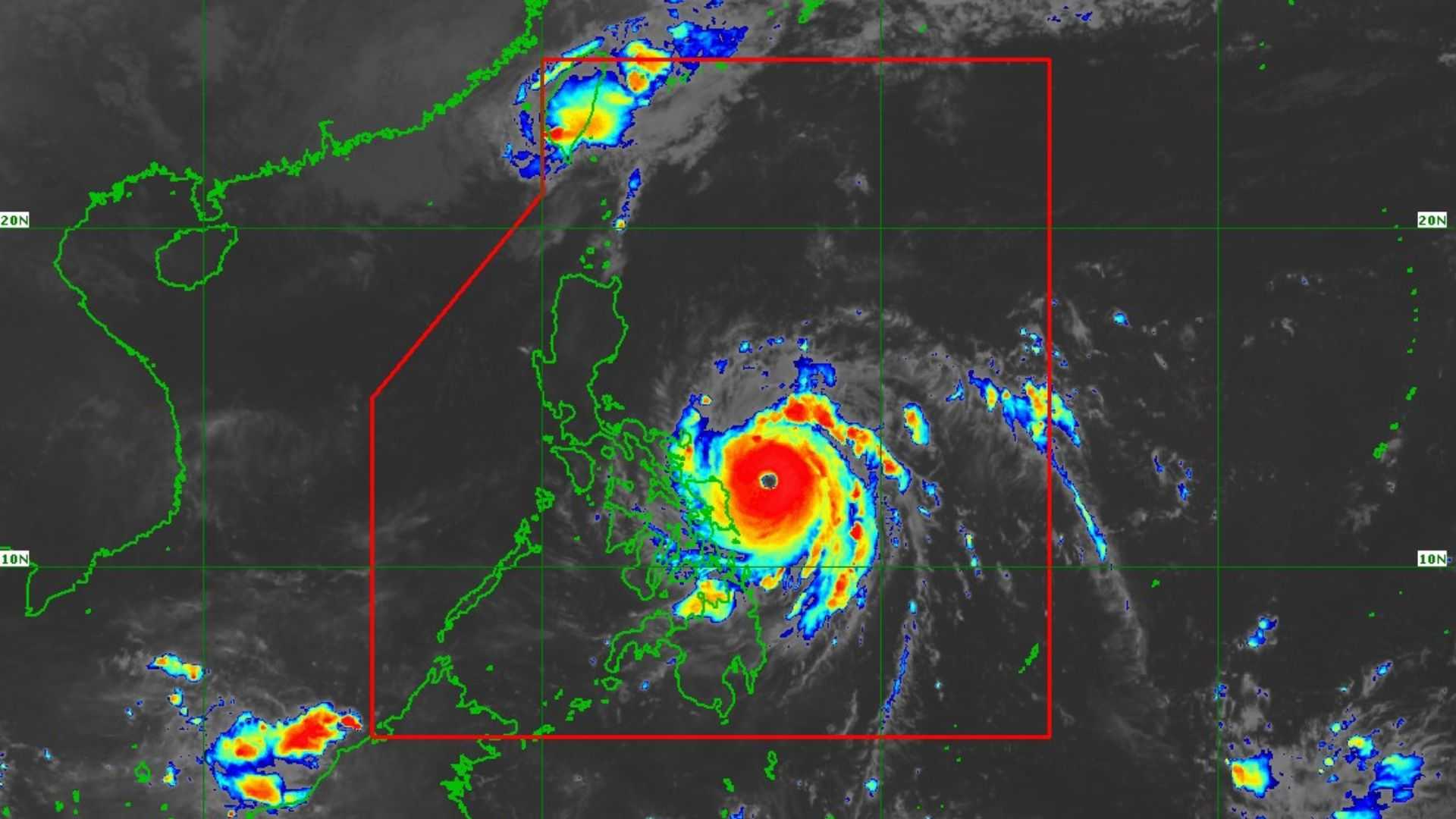

Typhoon Pepito continues to pose a threat over Southern Luzon and Eastern Visayas, nearing super typhoon category, the weather bureau reported on Saturday.
In its 8 AM weather bulletin, PAGASA reported that Typhoon Pepito is located 235 km east of Catarman, Northern Samar, with maximum sustained winds of 175 km/h, gusts of up to 215 km/h, and is moving northwestward at 25 km/h.
Tropical Cyclone Wind Signal (TCWS) No. 3 is in effect in the following areas:
Luzon
- Catanduanes
- the eastern portion of Albay
- the eastern portion of Camarines Sur
- the easternmost portion of Sorsogon (Prieto Diaz)
Visayas
- the eastern portion of Northern Samar
- northernmost portion of Eastern Samar
Residents in the affected areas are warned of the potential impacts of winds, which pose a moderate to significant threat to life and property.
TCWS No. 2 is hoisted in the following areas:
Luzon
- the rest of Camarines Sur
- the rest of Albay
- the rest of Sorsogon
- Ticao Island
- Camarines Norte
- the northeastern portion of Quezon including Pollilo Islands
Visayas
- the northern portion of Eastern Samar
- the northern portion of Samar
- the rest of Northern Samar
TCWS No. 1 is raised in the areas of:
Luzon
- Metro Manila
- the rest of Masbate including Burias Island
- Marinduque
- Romblon
- the rest of Quezon
- Laguna
- Rizal
- Cavite
- Batangas
- Zambales
- Bataan
- Bulacan
- Pampanga
- Tarlac
- Nueva Ecija
- Aurora
- Quirino
- Nueva Vizcaya
- Isabela
- mainland Cagayan
- Pangasinan
- La Union
- Ilocos Sur
- Ilocos Norte
- Abra
- Apayao
- Kalinga
- Mountain Province
- Ifugao
- Benguet
Visayas
- the rest of Eastern Samar
- the rest of Samar
- Biliran
- the northern and central portions of Leyte
- the northeastern portion of Southern Leyte
- the northernmost portion of Cebu including Bantayan Islands
- northernmost portion of Iloilo (Carles)
Mindanao
- The northern portion of Dinagat Islands
"There is a high risk of life-threatening storm surge with peak heights exceeding 3.0 m in the next 48 hours over the low-lying or exposed coastal localities of Eastern Samar, Northern Samar, Samar, Bicol Region, Marinduque, Quezon including Polillo Islands, Cavite, Batangas, Metro Manila, Central Luzon, Isabela, and Ilocos Region," PAGASA reported.
Typhoon Pepito is expected to move west-northwest over the next three days, then shift westward to west-southwest from Monday afternoon, 18 November to early Thursday, 20 November.
Furthermore, landfall is likely to occur near Catanduanes tonight or early Sunday morning.
Given the uncertainty in the forecast cone, a landfall over parts of Camarines Sur, Albay, Sorsogon, Quezon, or Aurora cannot be ruled out.
"Pepito" is expected to continue intensifying today and may reach super typhoon status within the next few hours, just before its landfall tonight or early tomorrow morning.
Meanwhile, it is expected to exit the Philippine Area of Responsibility (PAR) on Monday.
The next tropical cyclone bulletin will be released at 11:00 AM today.
