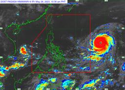
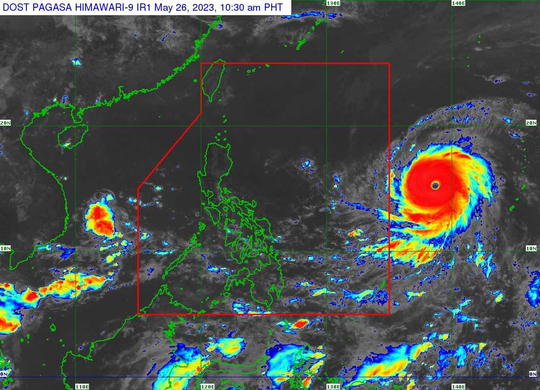
Super Typhoon Mawar has slightly intensified as it moves westward outside the Philippine Sea, the state weather bureau PAGASA said Friday.
In its 11 AM weather bulletin, PAGASA said ST Mawar was last seen at 1,705 east of southeastern Luzon while moving west at 20 km/h. It has a strength of 215 km/h near the center, gustiness of up to 260 km/h.
Mawar is expected to enter the Philippine Area of Responsibility (PAR) by Friday night or Saturday morning. It will be given the local name "Betty."
PAGASA said the super typhoon is forecast to reach its peak intensity within 24 hours and may slightly weaken by Saturday evening. However, it is expected to remain as a super typhoon until Monday.
In a press briefing, PAGASA weather specialist Ana Clauren-Jorda said Tropical Cyclone Wind Signal No. 2 or 3 will be raised by Saturday evening, particularly in the areas of extreme northern portion of Luzon, particularly in Batanes and Babuyan Islands.
Wind signal may also be raised over the eastern portion of central Luzon in the coming days, she added.
PAGASA said Mawar may also enhance the southwest monsoon or Habagat, which may bring monsoon rains over the western portions of Central Luzon, Southern Luzon, and Visayas starting Sunday or Monday.
President Ferdinand 'Bongbong' Marcos earlier said the national government is ready to assist local government units (LGUs) that will be affected by Mawar.
"We have already warned the LGUs to prepare in case of heavy rains and flooding. So ang aming ginagawa ay we leave it to the LGUs right now to make the call kung ano ang gagawin nila," Marcos told reporters at a Philippine Navy event.
"Pero nandito lang, sinasabi namin the national government is here to assist. We are in constant contact with the local governments para makita natin what is the situation in their place," he added.