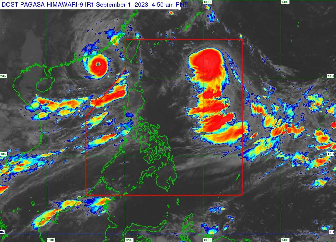

Tropical cyclone Hanna has further intensified into a typhoon as it continuously enhances the southwest Monsoon or Habagat, bringing more rains in several parts of the country on the first day of September.
In its 11 AM weather bulletin, the state weather bureau PAGASA said that Typhoon Hanna was last seen 785 kilometers East Northeast of Itbayat, Batanes with maximum sustained winds of 120 km/h near the center, gustiness of up to 150 km/h, and central pressure of 975 hPa.
The weather disturbance is presently moving westward at 20 km/h.
According to PAGASA, Typhoon Hanna is less likely to directly bring heavy rainfall over the country, but the enhanced Habagat will bring occasional monsoon rains over the western portion of Luzon in the next three days.
The enhanced Southwest Monsoon or Habagat will also bring gusty conditions over Batanes, Ilocos Region, Cordillera Administrative Region, Zambales, Bataan, Aurora, Bulacan, Metro Manila, CALABARZON, MIMAROPA, Bicol Region, Western Visayas, and the northern portion of Eastern Visayas, the state weather bureau added.
It is expected to reach its peak intensity on Saturday before its close approach or landfall over northern Taiwan, it noted.
PAGASA said Hanna may leave the Philippine Area of Responsibility on Sunday morning.
Following the heavy rains, several classes and work on local government units were suspended on Friday.
Local airlines also announced cancelations of flights for today.
