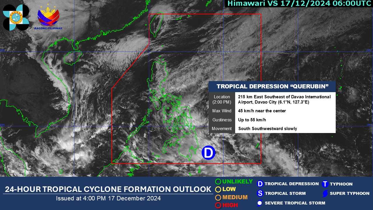

The low-pressure area at the east of Davao del Norte developed into tropical depression “Querubin” on Tuesday, 2 PM, the DOST-PAGASA said in its bulletin.
The weather bureau issued a weather forecast at 4 PM on Tuesday, detailing the information on the tropical depression. At 3 PM, the center of Querubin was estimated to be “215 km East Southeast of Davao City (6.1°N, 127.3°E) with maximum sustained winds of 45 km/h near the center and gustiness of up to 55 km/h.”
According to the DOST-PAGASA Weather Specialist Veronica Torres, the tropical depression is moving South Southwestward slowly.
Areas within Visayas and Mindanao will be affected, highlighting that Querubin and the shear line will bring moderate to intense rains in the Quezon and Bicol regions.
Moreover, the northeast monsoon would bring rain to the provinces of Cagayan Valley, the Cordillera Administrative Region (CAR), and Aurora.
From Tuesday to Wednesday (December 17 to 18), people from Dinagat Islands, Surigao del Norte, Surigao del Sur, and Davao Oriental will experience heavy to intense rain. Numerous flooding events are also likely to happen, as well as landslides in areas that are moderate to highly susceptible.
Areas to experience moderate to heavy rain this week also include:
- Quezon
- Bicol Region
- Visayas (Cebu, Bohol, Siquijor, Negros Occidental, and Negros Oriental)
- Camiguin Island
- Agusan del Norte
- Agusan del Sur
The PAGASA warned people to be careful around areas along Mt. Kanlaon for possible lahar, which may be intensified by the rain.
