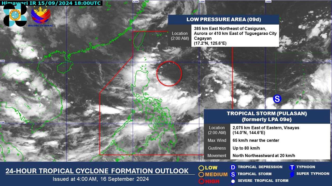
A tropical depression outside the Philippine Area of Responsibility (PAR) intensified into a tropical storm early Monday, now carrying the international name "Pulasan."
In its daily weather forecast bulletin, PAGASA reported that as of 3 a.m., "Pulasan" was located 2,205 km east of southeastern Luzon, with maximum sustained winds of 65 km/h near the center and gusts of up to 80 km/h. The storm is moving north-northeastward at 20 km/h.
Although the storm remains far from the country and is not yet affecting the Philippines, PAGASA said "Pulasan" could enter PAR in the coming days.
LPA near Aurora may develop into typhoon
Meanwhile, a low-pressure area (LPA) within PAR was last observed 375 km east-northeast of Casiguran, Aurora, or 400 km east of Tuguegarao City, Cagayan. The LPA is expected to intensify into a typhoon within the next 24 hours.
"Inaasahan natin na ngayong araw magdudulot ito ng kaulapan at malalakas na pag-ulan samalaking bahagi ng Northern part atb itong lalawigan ng Aurora," said Dan Villamil during Magandang Umaga Pilipinas.
Southwest Monsoon affecting Southern Luzon, Visayas, and Mindanao
The weather bureau also forecasts that the southwest monsoon, or habagat, will bring rains over Southern Luzon, Visayas, and Mindanao.
Monsoon rains are expected over northern Palawan, Occidental Mindoro, Aklan, Antique, and Negros Occidental. Occasional rains will also affect MIMAROPA, Western Visayas, and the Negros Island Region due to the southwest monsoon.
Cloudy skies with scattered rain showers and thunderstorms are forecast for the Ilocos Region, Cordillera Administrative Region, Cagayan Valley, and Aurora due to the LPA.
Metro Manila, Zamboanga Peninsula, BARMM, SOCCSKSARGEN, Caraga, Northern Mindanao, and the rest of Luzon and Visayas will experience cloudy skies with scattered rain showers and thunderstorms due to the southwest monsoon.
The rest of Mindanao will have partly cloudy to cloudy skies with isolated rain showers or thunderstorms, also due to the southwest monsoon.
Wind and Coastal Water Conditions
Strong winds from the southwest will affect the Visayas, the western section of Southern Luzon, and the western, northern, and eastern sections of Mindanao, causing rough coastal waters.
Moderate to strong winds moving southwest will prevail over the rest of Southern Luzon and Mindanao, with moderate to rough coastal conditions.
Meanwhile, the rest of Luzon will experience light to moderate winds from the northeast to northwest, with corresponding light to moderate coastal waters.