
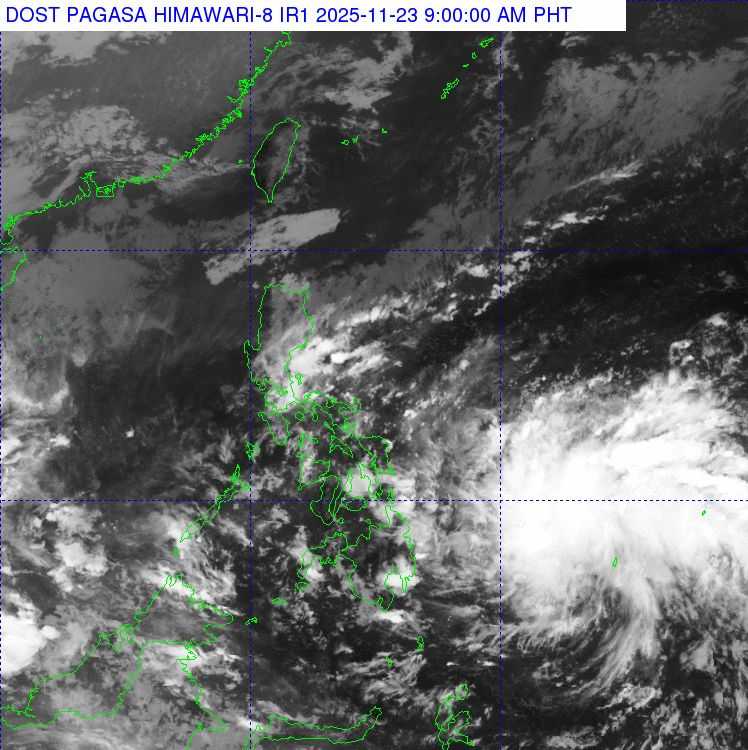
A low-pressure area (LPA) currently being monitored outside the Philippine Area of Responsibility (PAR) is expected to enter the country today, November 23, and may develop into a tropical depression by tomorrow, November 24.
According to PAGASA weather forecaster Obet Badrina, the LPA was last observed approximately 1,205 kilometers east of Southern Mindanao. It is expected to bring rainfall, particularly to eastern Visayas and parts of Mindanao, including Northern Mindanao, Caraga, Davao Region, and Bohol.
"Bukas, malaki ang posibilidad na ito ay maging bagyo at kikilos sa hilagang-kanluran. Kaya po, this week magiging maulan sa malaking bahagi ng Kabisayaan at Southern Luzon, kasama ang Bicol Region at MIMAROPA," Badrina reported.
From Wednesday to Thursday, light rains are expected in Manila and Central Luzon due to the effects of the low-pressure area.
Meanwhile, a gale warning has been raised for the waters off Batanes and the Babuyan Islands, making it dangerous for small vessels to sail.
According to PAGASA as of this morning, the Shear Line is affecting the eastern section of Northern Luzon, the Northeast Monsoon is affecting the rest of Northern Luzon, and the Intertropical Convergence Zone (ITCZ) is affecting Mindanao.
-
Apayao, Cagayan, Isabela, Quirino: Cloudy skies with scattered rain and isolated thunderstorms due to the shearline.
-
Aurora, Quezon, Camarines Norte: Cloudy skies with scattered rain and thunderstorms due to easterlies; flash floods and landslides are possible.
-
Cordillera Administrative Region and the rest of Cagayan Valley: Cloudy skies with rain due to the Northeast Monsoon.
-
Mindanao: Partly cloudy to cloudy skies with isolated rain showers or thunderstorms due to the ITCZ.
-
Metro Manila and the rest of the country: Partly cloudy to cloudy skies with isolated rain showers or thunderstorms due to easterlies.