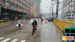

Persistent rains will persist over the areas in Visayas and Mindanao due to the low-pressure area off Mindanao, which is expected to develop into a tropical depression, according to the state weather bureau PAGASA on Wednesday.
The LPA was last seen at 710 kilometers east of Hinatuan, Surigao del Sur at 3 AM on Wednesday.
PAGASA said the weather disturbance is embedded along the Intertropical Convergence Zone (ITCZ) and could unleash scattered rain showers and thunderstorms over Eastern Visayas, Caraga, Bohol, Camiguin, Misamis Oriental, Davao de Oro, and Davao Oriental,
It warned that flash floods or landslides are possible due to moderate to at times heavy rains.
Metro Manila and the rest of the country could experience good weather, but possible thunderstorms may arrive in the afternoon or midnight, according to PAGASA.