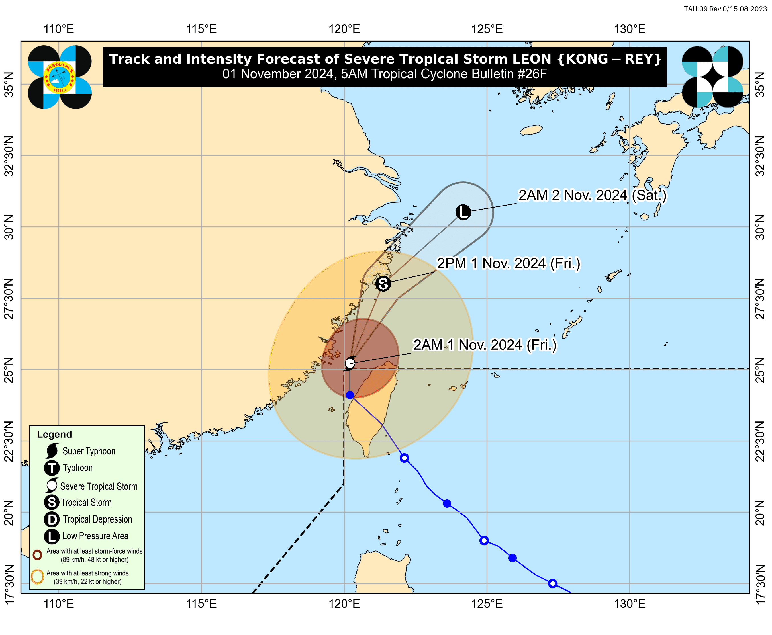

Leon has weakened into Severe Tropical Storm and exited the Philippine Area of Responsibility early Friday morning, November 1, according to PAGASA.
In a 5 a.m. Tropical Cyclone Bulletin issued by the state weather bureau, the center of the eye of Leon was estimated at 550 kilometers north northwest of Itbayat, Batanes, outside PAR, packing maximum sustained winds of 100 kilometers per hour near the center and gustiness of up to 140 kph.
Leon is moving northward at a speed of 20 kph.
Hazards affecting land areas
- Zambales, Bataan, Occidental Mindoro, and Palawan: These areas may experience cloudy skies with scattered rain showers and thunderstorms due to the trough of STS Kong-Rey (formerly Leon). Moderate to heavy rains could lead to flash floods or landslides.
- Metro Manila and the rest of the country: Expect partly cloudy to cloudy skies with isolated rain showers or thunderstorms due to localized weather. Severe thunderstorms could cause flash floods or landslides.
Wind and Coastal Waters Forecast
- Northern Luzon: Strong winds from the southwest to south will create rough coastal waters.
- Rest of Luzon: Moderate to strong winds from the southwest to south, with moderate to rough coastal waters.
- Visayas: Light to moderate winds from the southwest to south, with slight to moderate coastal waters.
- Mindanao: Light to moderate winds from the northeast to east, with slight to moderate coastal waters.
Severe Winds
Gusty conditions (strong to gale-force winds) are expected over the following areas outside Wind Signal zones, especially in coastal and upland areas exposed to winds:
- Batanes
- Babuyan Islands
- Northeastern mainland Cagayan
- Eastern Isabela
Track and Intensity Outlook
Leon, now outside the Philippine Area of Responsibility, is moving toward the East China Sea. It is expected to further weaken due to unfavorable environmental conditions.
No Tropical Cyclone Wind Signals are raised.
Sunrise today is at 5:52 a.m., and sunset will be at 5:28 p.m.
