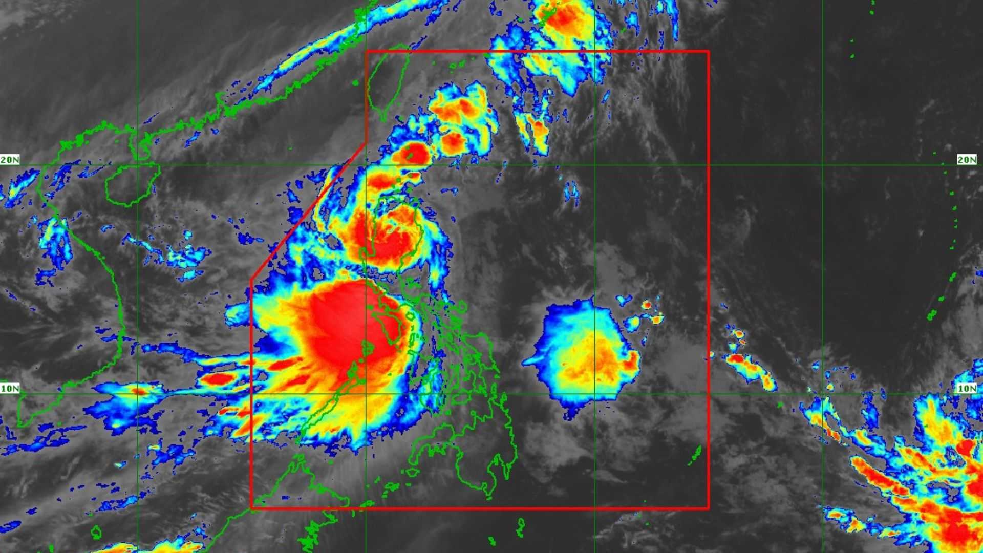

Severe tropical storm "Kristine" is now over the Cordillera Administrative Region (CAR), PAGASA reported early Thursday.
In its 8 AM bulletin, PAGASA reported that Severe Tropical Storm "Kristine" was located near Aguinaldo, Ifugao, with sustained winds of 95 km/h and gusts of up to 160 km/h, moving westward at 20 km/h.
The storm’s winds extend up to 730 km from its center, covering a broad area with strong storm-force winds.
Tropical Wind Signal No. 3 remains hoisted in the following areas:
- southern portion of Cagayan
- Isabela
- Quirino
- Nueva Vizcaya
- Kalinga
- Mountain Province
- Ifugao
- the southern portion of Abra
- Benguet
- northern and central portions of Aurora
- northern portion of Nueva Ecija
- northern portion of Tarlac
- northern portion of Zambales
- Pangasinan
- La Union
- central and southern portions of Ilocos Sur
Residents in these areas are advised of a potential moderate to significant threat to life and property due to winds associated with TCWS No. 3.
TCWS No. 2 has been raised in the following areas:
- Metro Manila
- Ilocos Norte
- the rest of Ilocos Sur
- Apayao
- rest of Abra
- rest of Cagayan including Babuyan Islands
- rest of Aurora
- rest of Nueva Ecija
- Bulacan
- rest of Tarlac
- Pampanga
- rest of Zambales
- Bataan
- Cavite Laguna
- Rizal
- Batangas
- northern and central portions of Quezon including Polillo Islands
- Lubang Island
There is a minor to moderate threat to life and property from the winds affecting these regions.
Furthermore, TCWS no. 1 is in effect in the following areas:
Luzon
- Batanes
- rest of Quezon
- rest of Occidental Mindoro
- Oriental Mindoro
- Marinduque
- Romblon
- northern portion of mainland Palawan including Calamian Islands and Cuyo Islands
- Camarines Norte
- Camarines Sur
- Catanduanes
- Albay
- Sorsogon
- Masbate including Ticao and Burias Islands
Visayas
- Aklan
- Capiz
- Antique including Caluya Islands
- Iloilo
- Bantayan Islands
- Northern Samar
- northern portion of Samar
- Biliran
- northern portion of Eastern Samar
- northwestern portion of Leyte
Residents are cautioned about a minimal to minor threat to life and property caused by the wind impacts.
Forecasts indicate that STS Kristine will cross Northern Luzon over the next 12 hours and may enter the waters west of the Ilocos Region this afternoon.
Moreover, STS Kristine is set to move west-northwest over the West Philippine Sea and is anticipated to exit the Philippine Area of Responsibility (PAR) by tomorrow afternoon, October 25.
An updated tropical cyclone bulletin will be provided at 11:00 AM today.
