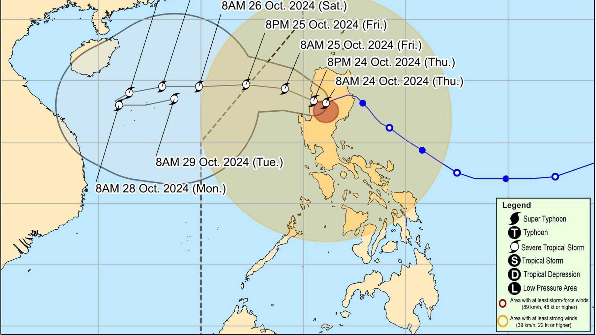

Severe tropical storm Kristine is continuously moving over the Cordillera Administrative Region (CAR), according to PAGASA.
In the weather bureau's bulletin issued at 11 AM on Thursday, Kristine was reported to be located near Bauko, Mountain Province. It has maximum sustained winds of 95 km/h and gusts of up to 160 km/h, while moving southwestward at 20 km/h.
The tropical cyclone's winds extend outward up to 730 km from its center, exhibiting strong to storm-force intensity.
Tropical Wind Signal No. 3 remains hoisted in the following areas:
- Mountain Province
- Ifugao
- Benguet
- Northern portion of Nueva Vizcaya
- Southern portion of Ilocos Sur
- La Union
- Pangasinan
The potential impacts of the winds pose a moderate to significant threat to life and property.
Furthermore, TCWS No. 2 is in effect in the following areas:
- Metro Manila
- Cagayan, including Babuyan Islands
- Isabela
- Quirino
- Rest of Nueva Vizcaya
- Apayao
- Kalinga
- Abra
- Ilocos Norte
- Rest of Ilocos Sur
- Nueva Ecija
- Aurora
- Bulacan
- Tarlac
- Pampanga
- Zambales
- Bataan
- Rizal
- Cavite
- Western portion of Batangas
- Northern portion of Laguna
Residents in these areas are advised of a potential minor to moderate threat to life and property due to winds associated with TCWS No. 2.
Moreover, TCWS No.1 is hoisted in the following areas:
Luzon
- Batanes
- Rest of Batangas
- Rest of Quezon
- Rest of Occidental Mindoro
- Oriental Mindoro
- Marinduque
- Romblon
- Northern portion of mainland Palawan including Calamian Islands, Cuyo, and Kalayaan Islands
- Camarines Norte
- Camarines Sur
- Catanduanes
- Albay
- Sorsogon
- Masbate including Ticao and Burias Islands
Visayas
- Aklan
- Capiz
- Antique, including Caluya Islands
- Iloilo
- Bantayan Islands
- Northern Samar
- Northern portion of Samar
- Biliran
- Northern portion of Eastern Samar
- Northwestern portion of Leyte
Strong winds are anticipated in areas under Tropical Cyclone Wind Signal No. 1, posing a minimal to minor threat to life and property.
STS Kristine is expected to leave the landmass of Luzon and emerge over the waters west of the Ilocos Region this afternoon.
The storm will then move west-northwest over the West Philippine Sea and is anticipated to exit the Philippine Area of Responsibility (PAR) tomorrow afternoon, October 25.
Meanwhile, there is a high chance that the low-pressure area (LPA) being monitored outside the Philippine Area of Responsibility (PAR) will develop into a tropical storm within the next 24 hours.
According to PAGASA, the LPA was last observed 2,295 kilometers east of Northeastern Mindanao. Once it enters the Philippine Area of Responsibility (PAR), it will be named Typhoon Leon.
The next update on the tropical cyclone will be available at 2:00 PM today.
