Tropical storm Kabayan weakened into a tropical depression and made landfall over Manay in Davao Oriental on Monday morning, Dec. 18, according to the Philippine Atmospheric, Geophysical, and Astronomical Services Administration (PAGASA).
In its latest bulletin, the state weather bureau said Kabayan made landfall over Manay, Davao Oriental at 9:30 AM today.
The tropical depression is expected to make another landfall over central or southern Palawan on the morning or afternoon of Tuesday, Dec. 19.
And after the landfall, PAGASA said Kabayan may shortly emerge over the West Philippine Sea.
The state weather bureau downgraded the Tropical Cyclone Wind Signal (TCWS) No. in Mindanao areas, from two to one.
- Misamis Oriental
- Camiguin
- Bukidnon
- Davao de Oro
- The northern portion of Davao Oriental (Baganga, Manay, Caraga, Tarragona, Lupon, Banaybanay, Boston, Cateel)
- Misamis Occidental
- Lanao del Norte
- Lanao del Sur
- Davao del Norte
- Davao City
- The northern portion of Cotabato (Arakan, Carmen, Banisilan, Alamada, President Roxas, Kabacan, Matalam, Antipas, Magpet, Libungan, Pigkawayan)
- The northern portion of Maguindanao (Buldon, Barira, Matanog, Parang, Sultan Kudarat, Sultan Mastura)
- The western and central portion of Zamboanga del Norte (Siayan, Sindangan, Jose Dalman, Manukan, Pres. Manuel A. Roxas, Sergio Osmeña Sr., Katipunan, Dipolog City, Polanco, Mutia, Piñan, Dapitan City, Sibutad, La Libertad, Rizal, Siocon, Baliguian, Gutalac, Labason, Kalawit, Tampilisan, Liloy, Salug, Godod, Bacungan)
- The western and central portion of Zamboanga del Sur (Midsalip, Labangan, Tukuran, Aurora, Sominot, Ramon Magsaysay, Tambulig, Dumingag, Mahayag, Josefina, Molave, Vincenzo A. Sagun, Guipos, Dimataling, Dumalinao, Lakewood, Dinas, San Pablo, Tigbao, Tabina, Kumalarang, Lapuyan, Pitogo, Margosatubig, San Miguel, Bayog, Pagadian City)
- Zamboanga Sibugay
- Dinagat Islands
- Surigao del Norte
- Agusan del Norte
- Surigao del Sur
- Agusan del Sur
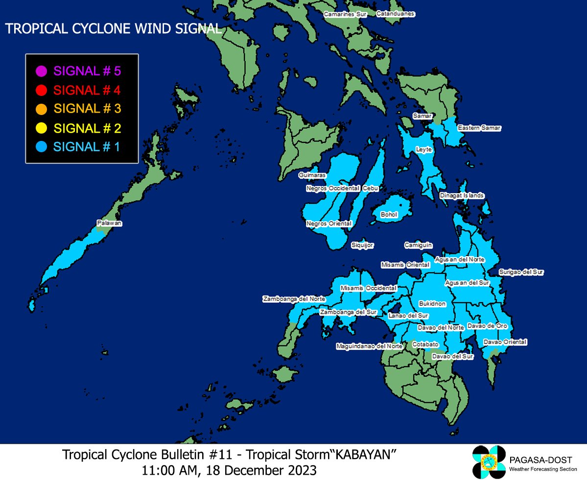
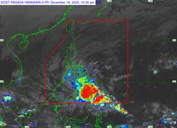
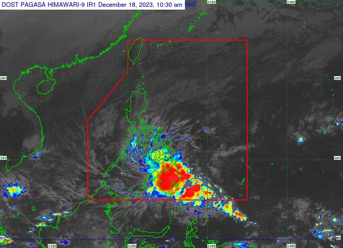
Photo courtesy: PAGASA / X account
TCWS No. 1 is also raised in the following Luzon areas:
- Southern Leyte
- Leyte
- The southern portion of Samar (Basey, Santa Rita, Marabut, Talalora, Villareal, Pinabacdao)
- The southern portion of Eastern Samar (Maydolong, City of Borongan, Quinapondan, Guiuan, Lawaan, Balangiga, Llorente, Giporlos, Salcedo, Balangkayan, General Macarthur, Hernani, Mercedes)
- Cebu including Camotes Islands
- Bantayan Islands
- Bohol
- Siquijor
- Negros Oriental
- Negros Occidental
- Guimaras
The tropical depression was last located in the vicinity of Caraga, Davao Oriental (7.3°N, 126.5°E), packing a 55 kilometer (km) per hour maximum sustained winds, 90 kph gustiness, and 1004 hPa central pressure.
According to PAGASA, Kabayan is accelerating at almost stationary speed or slow-moving.
“KABAYAN is forecast to track generally westward or west-northwestward path across the Philippine archipelago over the next two days,” it said.
The tropical depression may “cross the rugged terrain of Mindanao, and emerge over the Sulu Sea between this afternoon and evening.”
Kabayan may further weaken into a low-pressure area, but may re-develop once it is over the Sulu Sea.
“The current track and intensity forecast may still change given the nature and strength of this tropical cyclone,” PAGASA noted.