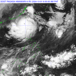
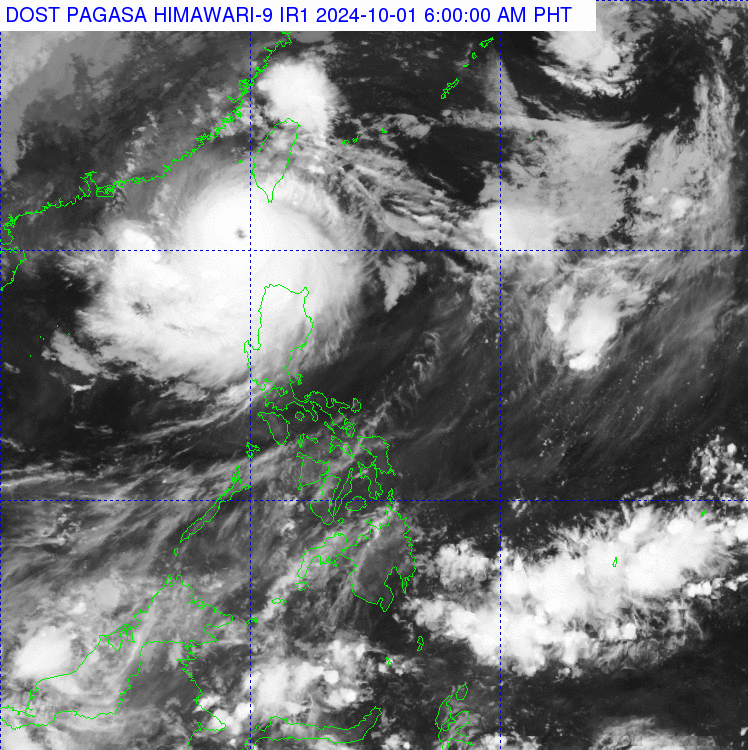
Super Typhoon Julian has gained strength, with PAGASA issuing Tropical Cyclone Wind Signal (TCWS) No. 2 in several areas.
As of the latest update of PAGASA, Julian’s center was located approximately 205 kilometers west of Itbayat, Batanes, with maximum sustained winds of 185 kilometers per hour (kph) and gusts reaching up to 230 kph. The typhoon is moving slowly and poses a significant threat to the northernmost parts of the country.
Areas Under TCWS No. 2:
- Batanes
- Babuyan Islands
- Northern Ilocos Norte (including Bacarra, Pagudpud, Burgos, and nearby areas)
- Northwestern Cagayan (covering Santa Praxedes, Claveria, and Sanchez-Mira)
Meanwhile, TCWS No. 1 is hoisted in:
- The rest of Ilocos Norte
- Ilocos Sur
- La Union
- Pangasinan
- Cordillera Administrative Region (Apayao, Kalinga, Abra, Mountain Province, Ifugao, and Benguet)
- Cagayan Valley (Isabela, Quirino, Nueva Vizcaya, and parts of Cagayan)
- Northern Aurora (including Dilasag, Casiguran, and Dinalungan)
- Northern Nueva Ecija (Carranglan, Lupao, Pantabangan)
Weather Conditions and Warnings
Stormy weather is expected in Batanes, Cagayan, Babuyan Islands, Apayao, and Ilocos Norte, with heavy to torrential rains that may trigger flash floods and landslides. Strong winds pose a minor to moderate risk to lives and property.
Other areas in the Ilocos Region, Cordillera Administrative Region, and Cagayan Valley will experience gusty winds and moderate to heavy rains.
Metro Manila, Central Luzon, and parts of CALABARZON may also experience scattered rains and thunderstorms due to Julian’s trough.
Severe Winds and Coastal Risks
The affected areas under TCWS No. 2 could experience gale-force winds, while areas under TCWS No. 1 might see strong winds with minimal to minor impacts. PAGASA also warned of gale-force gusts in exposed coastal and upland areas across the Ilocos Region, Cordillera, Cagayan, and parts of Central Luzon and CALABARZON.
There is a moderate to high risk of life-threatening storm surges over low-lying coastal areas in Batanes and Babuyan Islands. Mariners are advised to avoid sea travel as high waves, reaching up to 7 meters, are expected in Batanes’ coastal waters.
Track and Intensity Outlook
Julian is projected to move toward the sea southwest of Taiwan within the next 24 hours. The storm is expected to make landfall in Taiwan by Wednesday, then cross the island’s rugged terrain before exiting towards the East China Sea by Thursday.
PAGASA has raised a Gale Warning for the northern and western seaboards of Northern Luzon. Sea travel remains risky across many areas, especially for small vessels, due to very rough to moderate sea conditions ranging from 2.5 to 7 meters in height.
Mariners are urged to stay in port until conditions improve.