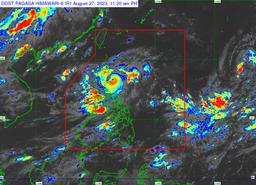
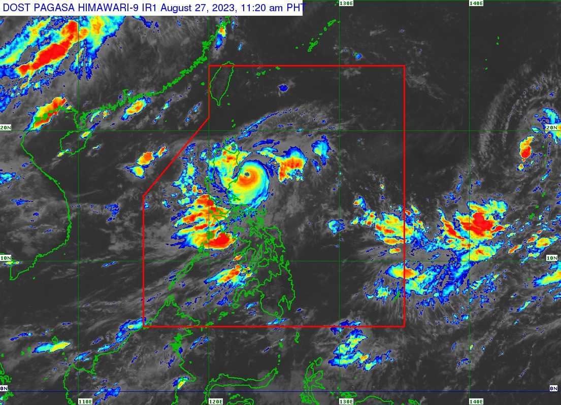
Tropical Cyclone Wind Signal (TCWS) No. 3 remain hoisted in the eastern portion of Isabela province as Super Typhoon Goring maintains strength, the state weather bureau said on Sunday, August 27.
In its 11 AM bulletin, PAGASA said Goring is packed with maximum sustained winds of 185 kilometers per hour (kph) near the center and gustiness of up to 230 kph.
The center of the eye of the super typhoon was last tracked 95 km east northeast of Casiguran, Aurora, and is accelerating south southwestward at the speed of 10 kph.
TCWS No. 3:
- Eastern portion of Isabela (Divilacan, Palanan, Dinapigue, Ilagan City, San Mariano)
TCWS No. 2:
- Eastern portion of mainland Cagayan (Peñablanca, Baggao, Gattaran, Lal-Lo, Gonzaga, Santa Teresita, Buguey, Santa Ana, Enrile, Tuguegarao City)
- Northern and central portion of Isabela (Maconacon, Cabagan, Tumauini, San Pablo, Benito Soliven, San Guillermo, Jones, Echague, San Agustin, Angadanan, City of Cauayan, Naguilian, Gamu, Santa Maria, Santo Tomas, Delfin Albano, Quirino, Burgos, Reina Mercedes, Alicia, Luna, Quezon, Mallig, Roxas, San Manuel, Aurora, Cabatuan, San Mateo, San Isidro)
- Extreme northern portion of Aurora (Casiguran, Dinalungan, Dilasag)
- Eastern portion of Quirino (Maddela)
TCWS No. 1
- Batanes
- the rest of Cagayan including Babuyan Islands
- the rest of Aurora
- the rest of Quirino
- the rest of Isabela
- Apayao
- Nueva Vizcaya
- Ifugao
- Mountain Province
- Kalinga
- Abra
- eastern portion of Ilocos Norte (Pagudpud, Adams, Vintar, Carasi, Nueva Era, Banna, Marcos, Dingras, Solsona, Piddig, Dumalneg, Bangui)
- Pollilo Islands
- eastern portion of Benguet (Bokod, Buguias, Kabayan, Mankayan)
- eastern portion of Nueva Ecija (Carranglan, Pantabangan, Bongabon, Gabaldon, Laur, Rizal)
- Calaguas Islands
PAGASA said areas placed under TCWS should take precautions due to the Goring-induced general wind threat.
“Local winds may be slightly stronger/enhanced in coastal and upland/mountainous areas exposed to winds. Winds are less strong in areas sheltered from the prevailing wind direction,” it noted.
According to the state weather bureau, Goring will remain in the super typhoon category until it makes landfall over the southern portion of Taiwan on Wednesday evening, August 30, or on Thursday early morning, August 31.
PAGASA said Goring is expected to emerge over the Taiwan Strait and exit the Philippine Area of Responsibility (PAR) on Friday, September 1.
Meanwhile, the state weather bureau said that the western portions of Central Luzon, Southern Luzon, and Visayas may experience occasional or monsoon rains due to the enhanced southwest monsoon.
The enhanced Southwest Monsoon will also continue to bring gusty conditions in Aurora, Bataan, Metro Manila, CALABARZON, MIMAROPA, Bicol Region, Visayas, Dinagat Islands, and Camiguin on Sunday.