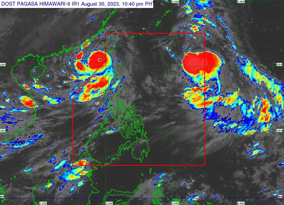

Super Typhoon (STY) Goring left the Philippine Area of Responsibility (PAR) on Wednesday evening, according to the Philippine Atmospheric, Geophysical and Astronomical Services Administration (PAGASA).
As of 4 AM on Thursday, PAGASA weather specialist Benison Estareja said STY Goring was tracked 335 kilometers (km) west of Itbayat, Batanes.
“Malakas pa rin ito kumpara kay Hanna na nasa 195 kilometers per hour ang sustain winds niya malapit sa kaniyang mata at may pagbugso na umaabot sa 240 kilometers per hour,” he said in a weather briefing.
STY Goring is traveling westward at the speed of 20 km per hour (kph).
“At base sa pagtaya ng PAGASA, kikilos ito pakaliwa at patungo dito sa Southern China at matamaan directly ang Hong Kong and Macau. Kaya ang ating kababayan doon ay pinag-iingat natin dahil sa masungit na panahon over the weekend,” Estareja said.
HEAVY RAINFALL DUE TO ENHANCED SOUTHWEST MONSOON
Even though STY Goring exited the country’s premises, it will enhance the southwest monsoon or habagat, the state weather bureau said.
According to PAGASA’s latest weather advisory, 50 to 100 milliliters (mm) of rain will be felt in Metro Manila, La Union, Pangasinan, Benguet, Tarlac, Pampanga, Bulacan, and Calamian Islands on Thursday.
On Friday, Metro Manila, Ilocos Region, Abra, Benguet, Tarlac, Nueva Ecija, Pampanga, Bulacan, Rizal, and Calamian Islands will experience rainfall of 50 to 100 mm.
On Saturday, Metro Manila, Ilocos Region, Tarlac, Nueva Ecija, Pampanga, Bulacan, Rizal, Cavite, Batangas, and Calamian will also have rainfall of 50 to 100 mm.
About 100 to 200 mm of rain will be felt in Zambales, Bataan, and Occidental Mindoro from Thursday until Saturday.
The state weather bureau warned of the possible flooding and rain-induced in the aforementioned areas.
