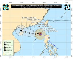
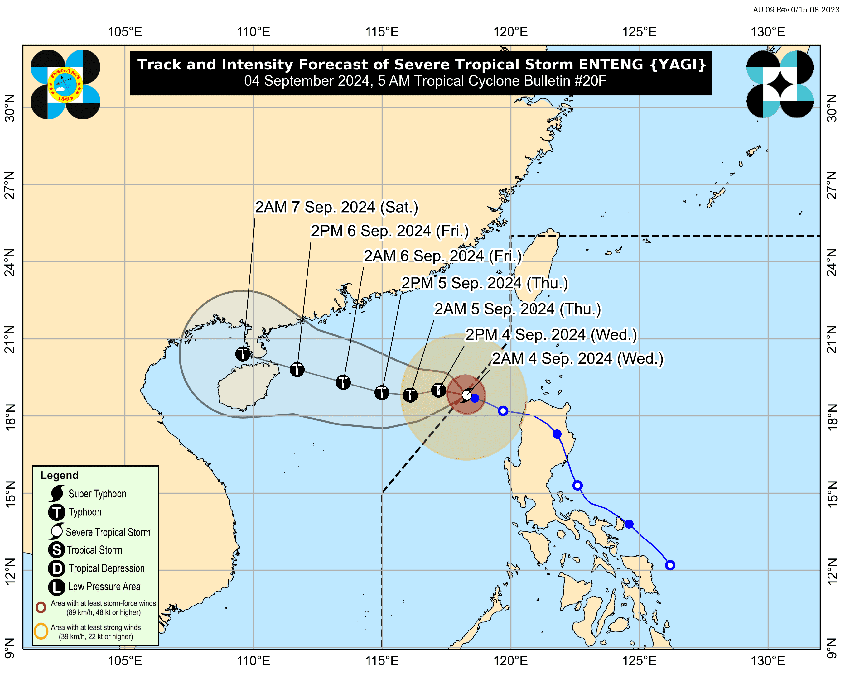
As of 5:00 AM on Wednesday, Severe Tropical Storm Enteng has slightly intensified but has moved outside the Philippine Area of Responsibility (PAR), according to PAGASA.
The center of Enteng was located 265 kilometers west-northwest of Laoag City, Ilocos Norte, now outside the PAR, and is slowly moving west-northwestward.
Enteng currently has maximum sustained winds of 100 km/h near its center, with gusts reaching up to 125 km/h.
No tropical cyclone warning signals have been raised at this time.
However, the enhanced Southwest Monsoon is expected to bring strong to gale-force winds over the Ilocos Region, Abra, Benguet, Isabela, Zambales, Bataan, Aurora, Bulacan, Metro Manila, CALABARZON, MIMAROPA, Bicol Region, Western Visayas, Negros Island, and Northern Samar.
A Gale Warning is in effect for the northern and western seaboards of Northern Luzon, as well as the western seaboards of Central and Southern Luzon. Sea travel is deemed risky for small sea vessels, including motorbancas.
Outside the PAR, Enteng is expected to continue moving generally westward until tomorrow, September 5, before shifting west-northwestward for the remainder of the forecast period.
The storm is forecast to make landfall in the southern mainland China area over the weekend.