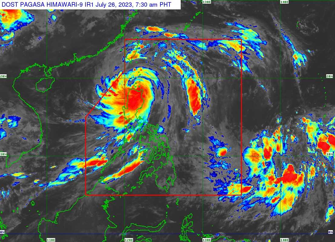

Four areas remained under Signal No. 4 as Typhoon Egay "wobbles" or slowed down over the waters near Fuga Island in Aparri, Cagayan province on Wednesday morning.
In its 8 AM bulletin, PAGASA said the center of the eye of Typhoon Egay was last seen in the coastal waters of Aparri, Cagayan.
It has maximum sustained winds of 175 kilometers per hour (kph) near the center, gustiness of up to 240 kph, and a central pressure of 935 hPa and is accelerating west-southwestward at the speed of 15 kph.
"In the next 6 hours, EGAY may exhibit trochoidal or wobbling motion while in the vicinity of the Babuyan Islands," the state weather bureau said.
PAGASA said there is a possibility that Typhoon Egay will landfall over northwestern Cagayan.
Typhoon Egay is forecasted to exit the Philippine Area of Responsibility (PAR) on Thursday morning.
"Outside the PAR region, EGAY will cross the Taiwan Strait and make landfall in the vicinity of Fujian, China on Friday morning," the state weather bureau said.
The following areas remained under Tropical Cyclone Wind Signal No. 4:
- Northern portion of Cagayan (Santa Ana, Gonzaga, Claveria, Sanchez-Mira, Pamplona, Abulug, Ballesteros, Aparri, Buguey, Santa Teresita, Camalaniugan, Santa Praxedes)
- Babuyan Islands
- Northern portion of Apayao (Calanasan, Luna, Santa Marcela)
- Northern portion of Ilocos Norte (Burgos, Bangui, Dumalneg, Pagudpud, Adams, Pasuquin, Vintar, Bacarra)
TCWS No. 3 is hoisted in the areas of:
- Batanes
- the rest of Cagayan
- the rest of Apayao
- the northern portion of Kalinga (Rizal, Pinukpuk, Balbalan)
- the northern portion of Abra (Tineg, Lagayan, Lacub, Danglas, Bangued, La Paz, San Juan, Dolores, Tayum, Lagangilang, Malibcong, Licuan-Baay, Peñarrubia, Pidigan, Langiden, San Quintin, Bucay, San Isidro, Sallapadan)
- the rest of Ilocos Norte
- the northern portion of Ilocos Sur (Magsingal, San Juan, Cabugao, Sinait, San Vicente, Santo Domingo, San Ildefonso, Bantay, Santa Catalina, City of Vigan, Caoayan, Santa, Nagbukel, Narvacan)
Meanwhile, the following areas are placed under TCWS No. 2:
- Isabela
- the rest of Kalinga
- Mountain Province
- Ifugao
- Benguet
- the rest of Abra
- the rest of Ilocos Sur
- La Union
- the northern and western portions of Pangasinan (Sison, San Jacinto, Pozorrubio, San Fabian, Dagupan City, Calasiao, Binmaley, Lingayen, Bugallon, Mabini, Labrador, Infanta, Dasol, Burgos, Agno, City of Alaminos, Sual, Anda, Bolinao, Bani, San Manuel, Binalonan, Laoac, Manaoag, Mangaldan, Mapandan, Santa Barbara, San Nicolas)
TCWS No. 1 prevailed over the areas of:
- Aurora
- Quirino
- Nueva Vizcaya
- the rest of Pangasinan
- Nueva Ecija
- Tarlac
- Pampanga
- Bulacan
- Zambales
- Bataan
- Metro Manila
- Rizal
- Cavite
- Laguna
- the northern portion of Batangas (Talisay, City of Tanauan, Santo Tomas, Balete, Malvar, Lipa City)
- the northern and central portion of Quezon (Pitogo, Calauag, Infanta, Lopez, Guinayangan, Unisan, Plaridel, Quezon, Alabat, Padre Burgos, Mauban, General Nakar, Perez, Agdangan, Gumaca, Atimonan, Real, Tagkawayan, Lucena City, Pagbilao, Lucban, Sampaloc, City of Tayabas, Dolores, Sariaya, Candelaria, Tiaong, San Antonio)
- Polillo Islands
- Camarines Norte
- the northern portion of Camarines Sur (Siruma, Tinambac, Goa, Lagonoy, Caramoan, Cabusao, Sipocot, Garchitorena, Ragay, Del Gallego, Calabanga, Presentacion, Lupi)
- the northern portion of Catanduanes (Pandan, Bagamanoc, Panganiban, Viga, Caramoran)
According to the state weather bureau, the aforementioned areas may experienced strong to typhoon-force winds that may threaten life and property.
Gale warning is still in effect over along the seaboards of Visayas and the northern and eastern seaboards of Mindanao.
"Mariners of small seacrafts are advised to take precautionary measures when venturing over these waters. If inexperienced or operating ill-equipped vessels, avoid navigating in these conditions," PAGASA warned.
