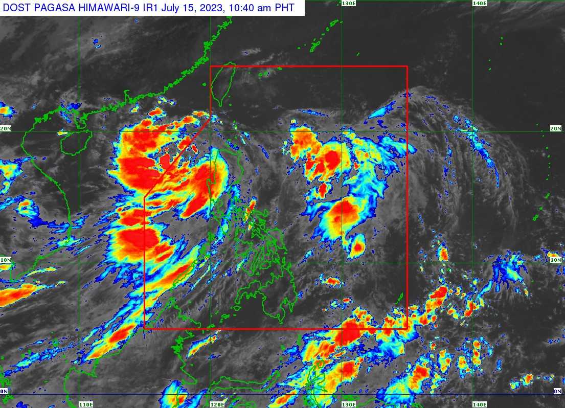
Tropical Depression (TD) Dodong has intensified into a tropical storm as it exits the Philippine Area of Responsibility (PAR), the Philippine Atmospheric, Geophysical and Astronomical Services Administration (PAGASA) said on Saturday.
In its 11 AM bulletin, Dodong was last spotted 305 kilometers West of Sinait, Ilocos Sur, packing 65 km per hour (kph) maximum sustained winds near the center and gustiness of up to 80 kph.
The tropical storm is now heading north-northwestward at the speed of 10 kph and is forecasted to move generally northwestward before it will turn northwestward.
"It may exit the Philippine Area of Responsibility (PAR) between this morning or in the afternoon," PAGASA said.
It said the tropical storm may intensify further and develop into a typhoon while over the West Philippine Sea on Monday.
TS Dodong will not cause heavy rainfall in any part of the country, but the enhanced southwest monsoon will bring frequent rains and gusty conditions.
According to PAGASA, areas that will experience frequent rains and gusty conditions on Saturday are Ilocos Region, Cordillera Administrative Region (CAR), Batanes, the eastern portion of Isabela, Quirino, Nueva Vizcaya, Zambales, Bataan, Bulacan, Pampanga, Aurora, Metro Manila, CALABARZON, MIMAROPA, Bicol Region, and Western Visayas.
"Under the influence of DODONG and the enhanced Southwest Monsoon, a marine gale warning is in effect over the northern and western seaboards of Luzon and Western Visayas," the state weather bureau said.
PAGASA lifted all the wind signals in Luzon provinces.