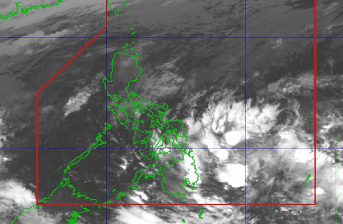

Cloud clusters just beyond the Philippine Area of Responsibility (PAR) may develop into a low-pressure area (LPA), said the state weather bureau, who are monitoring the area.
The Philippine Atmospheric, Geophysical and Astronomical Services Administration (PAGASA) located these clusters east of Mindanao.
“Continued monitoring po tayo dito sa mga cloud clusters or kaulapan na ito sa posibilidad na ito ay magkaroon ng circulation at maging isang ganap na low pressure area within the next 24 to 48 hours,” forecaster Grace Castañeda reported for PAGASA’s 4 AM weather update.
(We are continuously monitoring these cloud clusters due to the possibility of circulation and their developing into a low-pressure area within the next 24 to 48 hours.)
These cloud clusters and shearline are predicted to cause rainfall over Mindanao and Visayas, while the amihan (northeast monsoon) will pull in cloudy skies and rains over Cagayan Valley, the Cordillera Administrative Region (CAR), Aurora, and Quezon provinces.
Meanwhile, everywhere else, the easterlies may bring partly cloudy to cloudy skies, with isolated rain showers or thunderstorms.
Coastal waters over Northern and Central Luzon will be rough to very rough due to strong gale winds moving northeast. The rest of Luzon and the eastern section of Visayas will experience moderate to strong winds and rough seas.
