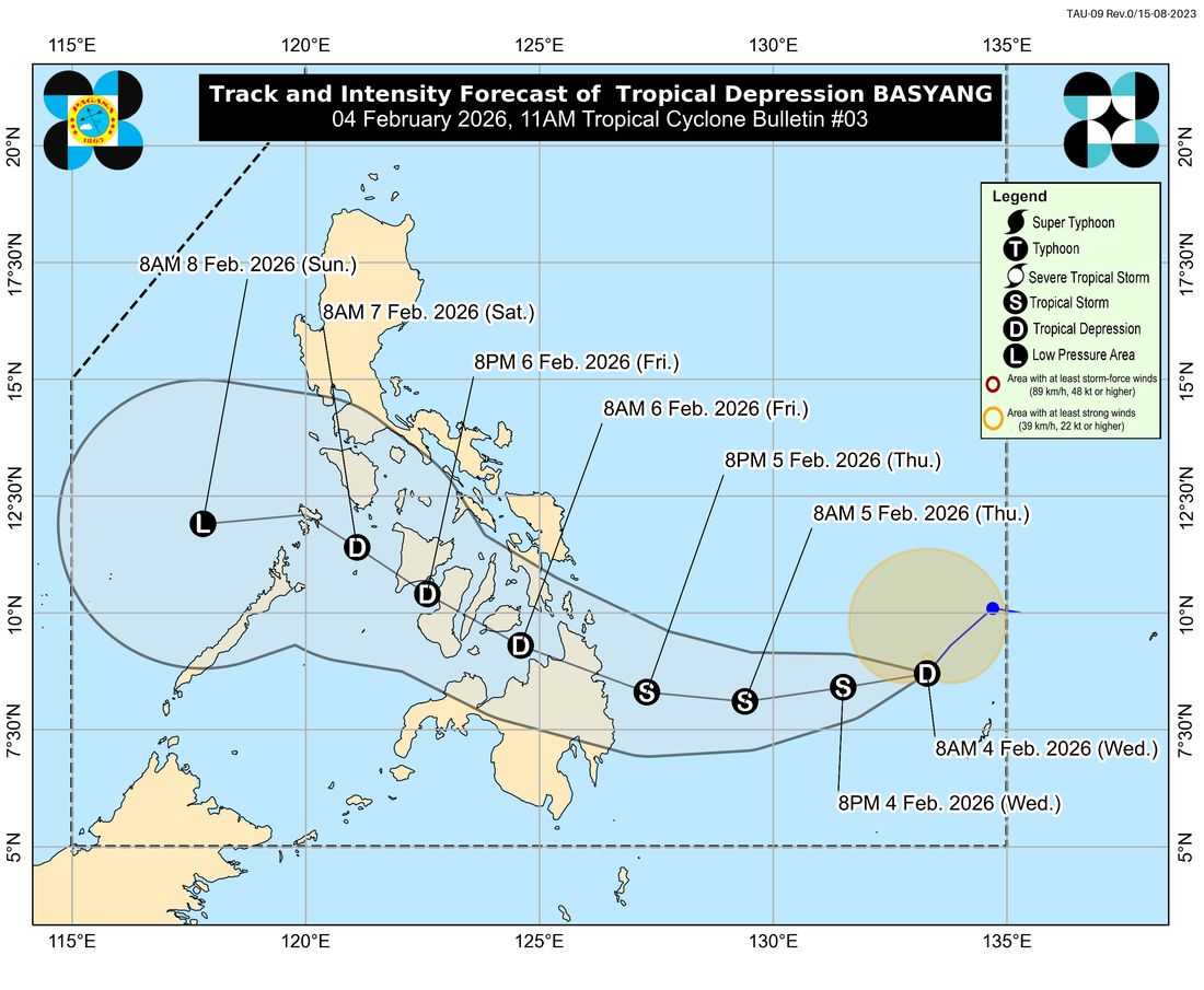
Tropical Depression Basyang continues to maintain its strength as it moves southwestward over the waters east of Mindanao, where Tropical Cyclone Wind Signal (TCWS) No. 1 remains in effect over parts of Surigao del Sur and the eastern portion of Surigao del Norte.
In its 11:00 a.m. advisory on Wednesday, PAGASA said the areas under Signal No. 1 include Surigao del Sur and the municipalities of Claver, Gigaquit, and Bacuag in Surigao del Norte, as well as the Siargao-Bucas Grande Islands.
Under Signal No. 1, wind speeds of 39 to 61 kilometers per hour may be experienced within 36 hours, posing minimal to minor threats to life and property. PAGASA added that the highest wind signal that may be raised during the passage of Basyang is TCWS No. 2.
Aside from strong winds, Basyang is expected to bring heavy rainfall over several areas, with PAGASA advising the public to monitor Weather Advisory No. 21 for detailed rainfall forecasts.
The weather bureau also warned of dangerous sea conditions, particularly along the eastern seaboard of Visayas. Very rough seas of up to 5 meters are expected over the seaboard of Surigao del Sur and the eastern seaboard of Siargao-Bucas Grande Islands, while up to 4.5 meters may affect the eastern seaboards of Northern Samar, Eastern Samar, Dinagat Islands, and northern Davao Oriental.
PAGASA said Basyang will generally move westward over the next 36 hours before turning west-northwestward starting Thursday evening. On its forecast track, the tropical depression is expected to make landfall over eastern Mindanao between Thursday evening and Friday morning.
Basyang may intensify into a tropical storm while over the Philippine Sea but is forecast to weaken after landfall and may be downgraded into a low pressure area by Sunday, February 8.
PAGASA urged residents in affected areas to remain alert, avoid unnecessary sea travel, and follow advisories from local authorities.