At least 12 areas across the Philippines have been placed under Tropical Cyclone Wind Signal (TCWS) No. 1 as Tropical Depression Aghon maintained its strength while moving west-northwestward on Friday, May 24.
In its 11 AM weather bulletin, the state weather bureau PAGASA said the following areas are under TCWS No. 1:
Luzon
- Sorsogon
- Albay (Manito, Legazpi City, City of Tabaco, Rapu-Rapu, Santo Domingo, Malilipot, Bacacay, Malinao, Tiwi)
- Catanduanes
- Camarines Sur (Caramoan, Garchitorena, Presentacion, Sagñay, San Jose, Lagonoy, Tigaon)
Visayas
- Eastern Samar
- Samar
- Northern Samar,
- Leyte (Babatngon, Tacloban City, Palo, Tanauan, Tolosa, Dulag, Mayorga, Macarthur, Abuyog, Javier)
- Southern Leyte (Silago, Hinunangan, Hinundayan, Anahawan, San Juan, Liloan, Saint Bernard, San Ricardo, Pintuyan, San Francisco)
Mindanao
- Dinagat Islands
- Surigao del Norte including Siargao - Bucas Grande Group
- Surigao del Sur (Carrascal, Cantilan, Madrid, Carmen, Lanuza, Cortes, City of Tandag)
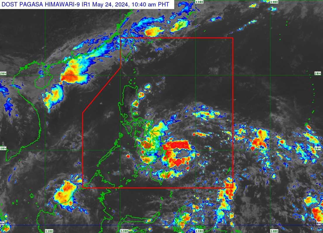
The center of TD Aghon was last seen at 240 km East of Hinatuan, Surigao del Sur. It has a maximum sustained winds of 45 km/h near the center, gustiness of up to 55 km/h, and central pressure of 1006 hPa.
PAGASA said it was moving west-northwestward at 10 km/h.
Aghon’s strong winds extend outwards up to 220 km from the center.
Track and Intensity outlook
Based on the track forecast, Aghon is expected to make landfall in the vicinity of Eastern Visayas on Saturday morning as a tropical storm.
Afterward, Aghon will pass north-northwestward over Eastern Visayas, then emerge over the waters off the east coast of the Bicol Region on Saturday evening as a tropical storm. On Sunday, it will begin recurving generally northeastward or north-northeastward over the waters east of Luzon while starting to continuously intensify.
PAGASA said the current forecast scenario shows intensification into a severe tropical storm by Sunday morning and into a typhoon by Tuesday.